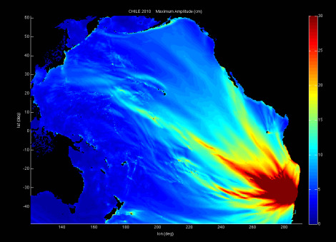
Maximum wave amplitude, computed with the Method of Splitting Tsunami model, developed by Titov of PMEL and Synolakis of University of Southern California, is the standard model used at the NCTR. MOST is a suite of numerical simulation codes capable of simulating three processes of tsunami evolution: earthquake, transoceanic propagation, and inundation of dry land

[Source: NOAA National Weather Service released February 27, 7:02am]

Tsunami advisory in effect for Coastal areas of California from Mexico to the Oregon border. 8.8 Earthquake in Chile at 22:34 PST, February 26. Significant widespread inundation is NOT expected for areas in an advisory; estimated times of initial wave arrival 12:31pm
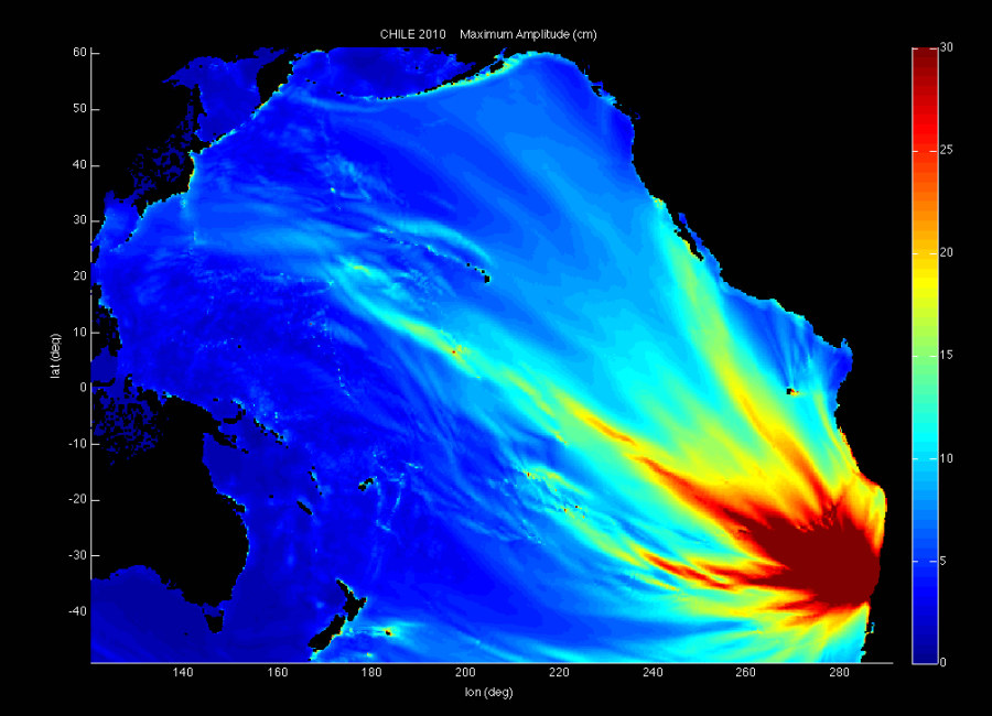
The Chile tsunami was generated by a Mw 8.8 earthquake (35.846°S, 72.719°W ), at 11:34 PST, February 26, 2010, 115 km (60 miles) NNE of Concepcion, Chile (according to the USGS). In approximately 3 hours, the tsunami was first recorded at DART® buoy 32412. Forecast results shown below were created with the NOAA forecast method using MOST model with the tsunami source inferred from DART® data.

Persons in tsunami advisory areas should move out of the water, off the beach and out of harbors and marinas.

Tsunami advisories mean that a tsunami capable of producing strong currents or waves dangerous to persons in or very near water is imminent of expected.

There is also a Flash Flood Watch currently in effect, due to the high rains. No reported flooding at this time.

Login

Please note this login is to submit events or press releases. Use this page here to login for your Independent subscription

Not a member? Sign up here.