A Legacy in Landscapes
Ten of Santa Barbara County’s Top Preservation Victories and Five Battles to Come
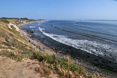
Spotting the morning swell over the meadow at Hammonds, catching a glimpse of the turtles at Alice Keck during your lunch break, hearing the friendly bark of dogs during a sunset stroll through the Wilcox, retreating to your tent under the stars at El Cap … these are the pleasures of living in Santa Barbara County, a land where open space and undeveloped nature is valued above most everything else.
This year, on the 40th anniversary of Earth Day — which itself was a reaction to the 1969 oil spill off the Santa Barbara coast — The Independent is celebrating those places that have been forever preserved by shining a light on 10 of our favorites. This legacy of landscapes is the result of hard work on the part of activists and everyday citizens who were able to wage war when necessary and compromise when called for. But praise must also go to the generous philanthropists and conservation-minded organizations — namely the Land Trust for Santa Barbara County, the Trust for Public Land, the Coastal Conservancy, the Environmental Defense Center (EDC), and various government agencies — who put up the big bucks and brought out the big guns needed to save these precious places.
And lest you think the work is done, we’re also presenting five landscape battles that are either already underway or coming soon to a hearing room near you. So this Earth Day, in between trips to the festival at Alameda Park, make sure to stop by one of these gems, take a deep breath, and give thanks for the open spaces we call our own.
Victories Won
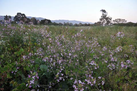
HAMMONDS MEADOW: Today, Hammonds Meadow is a permanently protected slice of heaven nestled among luxurious, sprawling, and aesthetically challenged development. And while the beach and the wilds of the now three-acre meadow are just a portion of the gentle and contemplative beauty that once reigned supreme along this stretch of Montecito’s coast, it is a beloved and accessible peace of mind for those who frequent it. However, from the 1960s through to the mid ’80s, it seemed the entire Hammonds Estate was doomed to fall victim to the bulldozers of development. After Esther Hammond passed away in 1955, her family’s sprawling estate became the flavor of the day for speculators. Already bookended by the Miramar Hotel to the east and the Biltmore to the west, the Bonnymede Condos, the first major build-out of the estate, were finished in 1965, exponentially shrinking the sacred ground the Chumash call Shalawa. With only an estimated 30 untouched acres left, the latter half of the decade saw a Los Angeles-based real estate company tempting would-be buyers with the potential to put apartment buildings six stories high in the neighborhood, while a project known as Vista del Montecito was actively seeking approval for a separate parcel of the former Hammonds Estate. Faced with these less-than-desirable futures, a grassroots coalition of meadow preservationists called Friends of Hammonds Estate formed in 1971, and thanks in large part to their efforts, the Vista was never built, although a more mellow version of it — several luxury condos called Montecito Shores — were completed in 1974.
After the Shores became a reality, only 20-some-odd acres of Shalawa remained and, by 1977, a 50-home project called Sea Meadow had that open space on the ropes. Resisted heavily by the Friends and a growing voice of concerned Chumash, the project was held up and whittled away at for a number of years during the county approval process. In 1984, a refurbished version of the plan was approved, paving the way for the lavish, slate-roofed, Normandy-style homes in the area today. More importantly, at least for the public at large, the new deal preserved the three acres that compose the meadow as we now know it. But even then, the fight wasn’t done. It took five more years of legal bickering to ensure public-trail access to the grassy paradise.
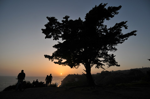
THE WILCOX PROPERTY: Perched atop the oceanfront mesa just east of Hendry’s Beach, the 70-acre Douglas Family Preserve (a k a the Wilcox property) is the largest open-space park within Santa Barbara City limits. But before it became a haven for dog walkers, bikers, painters, and fresh-air lovers in general, the property was ripe for building after the long-running Wilcox family nursery closed in 1972. (Old bits of infrastructure from the nursery remain hidden in the scrub brush of the park to this day.) Rescued by the Trust for Public Land from various development plans that included a retirement home, a luxury hotel, and a sprawling subdivision, the park was eventually turned over to city ownership in 1997. The gift was made possible in large part to an incredible outpouring of local financial support. In fact, more than $2 million of the $3.6-million purchase price came specifically from fundraising efforts in Santa Barbara. Chief among these was a check for $600,000 ponied up late in the game by actor Michael Douglas and thus earning the Montectio resident and his family naming rights.
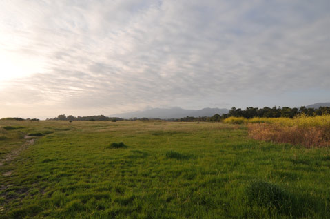
ELLWOOD MESA AND THE CORONADO BUTTERFLY PRESERVE: When the Elwood Bluffs officially became the property of the City of Goleta in February 2005, it concluded a nearly three-decade struggle for preservation. A collaborative effort between the City of Goleta, the Trust for Public Land, the Goleta Valley Land Trust, Friends of the Ellwood Coast, several public agencies, scores of residents, and an open-minded property owner, the officially named Sperling Preserve (thanks to a $5-million donation from Peter and Stephanie Sperling) is 137 acres of empty ocean-side mesa with meandering paths, shady eucalyptus groves, and world-class butterfly bonanzas during the winter months. Bought for $20.4 million, the deal that sealed the protection of the bluff top also featured a unique land swap with the property owner that gave them a 38-acre offsite parcel adjacent to Sandpiper Golf Course, formerly owned by the City of Goleta, that was ultimately developed with 62 town homes. Near Ellwood is the roughly 10-acre Coronado Butterfly Preserve, which was bought by the Santa Barbara Land Trust in 1998. A visually stunning migratory stop for the monarch butterfly flush with native plants and scrub sage, this small parcel serves as the de facto gateway to the Sperling Preserve.
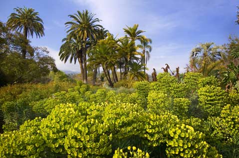
ALICE KECK PARK MEMORIAL GARDENS: A breath of fresh air in the heart of downtown Santa Barbara, Alice Keck Park Memorial Gardens make up a full city block’s worth of zen-like gardens, stunning plant and tree specimens, and koi ponds. Take a lunch break there or a casual evening stroll and you cannot help but feel the stresses of the modern world melt away. Interestingly enough, the site, which was once home to the famous El Mirasol Hotel, was well on its way to becoming, at various times, a new nine-story hotel, an 11-story condo development, or the future site of the Santa Barbara Museum of Art before being bought in 1975 by Alice Keck Park. Wishing to remain anonymous, Park turned the property in its entirety over to the city almost immediately after purchase. The donation remained a mystery in town until after Park’s death in 1977. The park was formally dedicated to her in 1980. As for the natural splendor of the place, that was overseen by the folks from the Santa Barbara Botanic Garden.
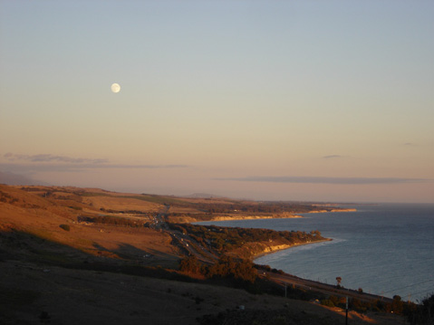
EL CAPITÁN: A highlight of the Gaviota Coast, El Capitán is a patchwork of private and public lands, rich with Chumash history, world-class nature, a touch of surf, and an irrefutable air of magic. If it weren’t for a people-powered preservation revolution in the early 1970s carried out to protect it, El Cap would be arguably the worst pockmark on the face of Santa Barbara County. In 1970, led by Selma Rubin and Anna Laura Myers, lovers of open space successfully staved off a plan to put more than 1,500 homes in the area as part of a full-scale development assault. Even more impressive, the save came despite a 4-1 vote of approval for the project from county supervisors. Rubin and company collected signatures and put it to a vote of the people. In the end, once the ballots were counted, Mother Nature won by a 2-1 margin.
Decades later, in 2002 to be exact, the Trust for Public Land, the Land Trust for Santa Barbara County, and new El Capitán area landowners Chuck Blitz and Roger Himovitz worked together to forever protect 3,000 acres in the area via a series of land deals. Carving up a huge parcel of land formerly owned by Texaco, the Land Trust bought 2,500 acres for $12 million from Blitz and Himovitz and promptly turned it over to the State Parks, creating a much-needed wildlife corridor running almost uninterrupted from the Pacific to the Los Padres National Forest. In a related deal, the Land Trust for Santa Barbara County helped create an agricultural easement on the remaining 650 acres, keeping them untouched save for the existing campground, horse ranch, and two as-yet undeveloped home parcels.
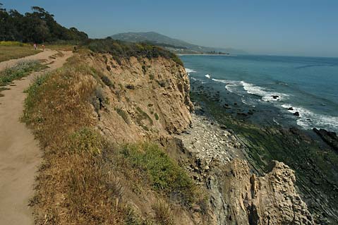
CARPINTERIA BLUFFS: An often overlooked treasure of the South Coast, the Carpinteria Bluffs offer eyefuls of ocean views and the Channel Islands beyond, as well as quiet seaside trails that give a glimpse of one of the county’s only seal haul-outs on the sand below. Formally the property of Carpinteria as of October 2000, the story behind the saving of the bluffs provides perhaps the singular most impressive fundraising effort in the storied history of Santa Barbara’s open-space saves.
Already at the negotiating table with property owner Shea Homes, Inc., folks from the Citizens for Carpinteria Bluffs and the Land Trust for Santa Barbara County got an offer from Shea: The 52-acre property could be theirs to keep undeveloped forever if they could come up with $3.95 million. The catch was that they had until December 31, 1998, and it was already August of that year. In short, they had to find about $35,000 a day to make their deadline.
Obviously, they pulled off the nearly impossible feat, thanks to the generosity of thousands of residents, four separate government entities, and 15 foundations. Even better, they ended with a surplus of $500,000, which was put into an endowment to ensure the proper maintenance of the property.
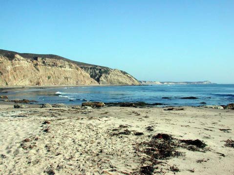
POINT CONCEPTION: One of the hottest potatoes in the California preservation patch during the 1970s and early ’80s was the fight to keep the waters and ranchland just east of Point Conception free of a liquefied natural gas (LNG) facility. Besides being the beginning of the bight of California, the area around Point Conception — known to the Chumash as the Western Gate — is a cultural haven and a glorious reminder of a California long since paved over. However, if the Western LNG Terminal Company (formed specifically for the project and comprising Southern California Gas and Pacific Gas and Electric) had gotten its way, it would have become home to a $1.6-billion LNG project complete with 127 tankers showing up regularly from Alaska and Indonesia, an onshore re-gasification plant near Little Cojo, and a piping process that would have spread the fuel out to Californians via the existing PG&E and SoCal Gas pipes.
Stalled by fierce local opposition — an impressive feat considering that the State Legislature was backing the project for much of its incubation period — the plan eventually died a slow death in 1986 when the Company officially pulled its application. But its legacy lived on for a few years longer, as utility subscribers continued to pick up the bill on a monthly basis for the tens of millions of dollars spent on the planning portion of the project.
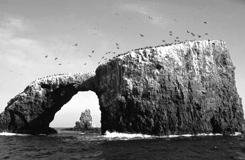
CHANNEL ISLANDS: If it weren’t for the long-gone Bureau of Lighthouses, which recommended protecting Anacapa and Santa Barbara islands in 1932, there might not even be the collection of outdoor and underwater cathedrals that compose the Channel Islands National Park. Increased support over the decades by Presidents Roosevelt, Truman, Kennedy, and Carter, News-Press publisher Thomas Storke, and Congressmember Bob Lagomarsino — among other bureaucrats and public policy shapers — led to the national-park designation and inclusion of Santa Cruz, Santa Rosa, and San Miguel islands, which also required the federal government to purchase Santa Rosa from the Vail and Vickers families, who had ranched the island for generations. The Nature Conservancy, meanwhile, remains the majority owner of Santa Cruz Island, but its preservation-minded intent aligns nicely with the National Park Service’s, and together they’re continually restoring the islands to their natural balance with invasive species eradication and endemic species support. Considered one of the least visited national parks, the islands entice Santa Barbara’s nature-loving masses every day, and they’re but a channel away.
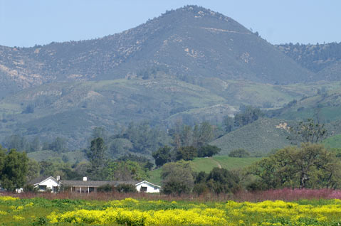
SEDGWICK RANCH: Although famed sculptor and cattleman Francis “Duke” Sedgwick clearly wanted to save his sprawling Santa Ynez Valley ranch at the base of Figueroa Mountain when he donated most of it to the University of California in 1967, the desire for an art museum at UCSB nearly skewered the sale of the Sedgwick Ranch in the late 1980s, around the same time that Sedgwick’s grown children were also angling to sell off their remaining 782 acres. Worried that the property would be developed into countless ranchettes (or even worse), a broad coalition of painters, researchers, and environmentalists rallied under the banner of “Save the Sedgwick” in the early 1990s. To the rescue came the Land Trust for Santa Barbara County, which raised the $3.2 million needed to buy the heirs’ acreage and then passed it over to UCSB with a promise that it would become a natural reserve. Today, the nearly 6,000-acre Sedgwick Reserve remains an educational, spiritual, and recreational refuge for schoolkids, hikers, scientists, and artists.
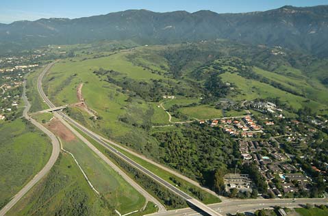
SAN MARCOS FOOTHILLS: No less than five serious attempts have been made to develop this pristine slice of the foothills, where the cityscape of Santa Barbara slides along Highway 154 into the rising peaks of the Santa Ynez Mountains. Thanks, historically, to a vigilant County Planning Commission — which shot down or dissuaded proposals for more than 500 units in 1980, a golf course/luxury suburb in 1990, a 900-student school in 1995, and a 75-home horse-minded project in 1999 — the San Marcos Foothills Coalition was able to form in 1999 and negotiate with developer Jeff Bermant. Together, they agreed in 2007 to preserve 200 of the 377 acres in exchange for the right to build 15 homes and five affordable condos in a less-sensitive corner of the property. As such, the resident burrowing owls and grasshopper sparrows can still fly above native grasses, rare freshwater seeps, beloved hiking trails, and unimpeded views of the entire South Coast.
Battles to Come

OIL: Even with the murderers’ row of oil rigs lined up just off our shore and the scores of derricks humping and thumping in our backcountry in search of the precious crude, the bottom line is this: The ground beneath us in Santa Barbara County and our oceanic backyard is holding bigtime when it comes to the liquid gold that makes the world go ’round. Because of this fact, conflict is guaranteed in the years ahead between the folks who want to harvest the oil and the people who, since 1969’s historic hemorrhage at Platform A brought devastation to our beaches, have worked tirelessly to prevent new offshore oil leases and reguRight now, new battle lines are being drawn as three separate projects have activists mobilizing. First is the Paredon Project in Carpinteria, which, with its proposed slant drilling of offshore reserves via an onshore facility, has successfully skirted around a traditional environmental review process and will be decided by a public vote, thanks to a ballot initiative slated for this November. Second is a planned large-scale pipeline by Venoco Energy in Goleta for its Ellwood facility. Third is the plan by PXP (Plains Exploration & Production Company) for the Tranquillon Ridge off the shore of Vandenberg Air Force Base. It offers up the first new offshore oil leases in California since 1968 in exchange for, among other things, hard-and-fast stop-drilling dates, billions of dollars of royalties to the state, and thousands of acres of PXP-owned land donated to public trust. Adding to the intrigue is the support for this plan coming from reputable and grizzled anti-drill watchdogs like EDC and Get Oil Out! (GOO!).

THE GAVIOTA COAST: Roughly 31,000 acres of largely undeveloped land make up the Gaviota region, a globally significant bastion of biodiversity and a rural reminder of a Southern California and a slower, less paved-over way of life that is otherwise extinct in this part of the world. West of Winchester Canyon and east of Point Conception, the character of this region is currently threatened by a vast spectrum of development projects running the approval gauntlet: ranging from mansions at its easternmost gate (Matt Osgood’s Naples vision) to a very big question mark surrounding the intentions of the relatively new owners of the 24,000-acre Bixby-Cojo Ranch at the Gaviota Coast’s western boundary. According to county documents, projects are presently proposed for nearly 30 percent of the area.
MORE MESA: Beset on all sides by mansions, townhomes, and gated communities, it’s a miracle that there isn’t already a subdivision sitting where the white-tailed kites roost on More Mesa, the roughly 300 acres of coastal bluff-top savannah and woodland located in eastern Goleta. Although the Land Trust for Santa Barbara County saved the 36 northwestern acres in 1991, the rest of More Mesa — which is crisscrossed by hiking/biking/horse trails, used every day as beach access, and recognized by the county as sensitive habitat — remains owned by Sinclair Oil Corporation owner R. Earl Holding, the 59th richest man in America, who developed Utah’s Sun Valley and Snowbasin ski resorts. Holding recently offered to sell the currently six-parcel property for $110 million — an amount that would require development to pay off — but there were no takers. Whether a rebounded economy would prompt someone to buy the land and pursue the roughly 70 units possible given the current environmental considerations remains a threat. Or maybe, just maybe, Holding, who’s now in his eighties and paralyzed from a stroke, could leave a nice legacy for Santa Barbara by simply preserving the cherished land forever.

BISHOP RANCH: These rolling, tree-dotted grasslands — which are visible on the mountain side of 101 between the Los Carneros and Storke Road offramps — sit as an agriculturally zoned but not actually farmed island in the middle of the City of Goleta. Though fenced off from visitors, except for the once-a-year tree tours, many South Coasters appreciate the 240-acre property’s bucolic views and the resulting memories of how things once were. But all that may change, for just last week, the Bishop Ranch LLC submitted conceptual plans for nearly 1,200 homes, a commercial center, parkland, and roadways on the site. The Bishop Ranch battleground will force Goleta residents and decision-makers to confront a deeply philosophical question: Is this a city that wants to grow within its borders or should open space be saved at all costs?
CAMP FOUR: The recent sale of nearly 1,400 acres of prime Santa Ynez Valley real estate by the Fess Parker family to the Santa Ynez Band of Chumash Indians is steadily raising eyebrows throughout the county, as everyone wonders what the tribe — whose nearby casino development didn’t win them many neighborhood friends — plans to do with the Camp Four property, which is located northeast of the highways 154 and 246 intersection. If a joint Parker-Chumash proposal from 2005 is any indication, the property, which is currently zoned ag with 100-acre minimum parcels, might one day be home to luxury resorts and golf courses. Or maybe the Chumash will just build some nice mansions there. The current problem is that no one knows what’s in the works because the Chumash simply won’t say much to anyone. And to many concerned about keeping that area rural, such silence is scary.


