Rattlesnake Canyon Loop
A Half Day Hike in the Front Country

Many Santa Barbarans have made the steep ascent up Rattlesnake Canyon to the big potrero where the wilderness path forks (aka Tin Shack Meadow), often returning the same way to complete a lovely 3.4 miles roundtrip. For those who want a challenging and different half-day workout, try my Rattlesnake-Tunnel bike/hike design. You get way out in wild nature, save gas, don’t need a partner, and enjoy eight miles of terrain with the loop-shuttle scheme.
I arrived at the top of Tunnel Road alone in my dusty pickup truck on a foggy July 3 morning just four miles from my Westside home. I quickly unloaded my 15-year-old Specialized mountain bike after assiduously parking inside the bright white line. (If it’s a “red tag” day, all street-side parking is forbidden in this area.) Even at 8 a.m., it was warm.
The almost three-mile bike ride along Mountain Drive winds wonderfully east to Rattlesnake Canyon along steep hillsides. Marine-layer fog enshrouded the overhanging hoary oaks and colorful native landscaping, but the road becomes a steep ascent as you near St. Mary’s Seminary and cross the stunning 1919 Las Canoas Road stone bridge to Skofield Park, where I locked my bike.
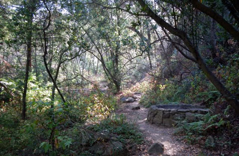
I entered Rattlesnake Canyon Wilderness Area, and I immediately accepted the morning silence, broken only by water music from gurgling Rattlesnake Creek. During the 5.3-mile moderate hike across the brown and yucca-strewn ridges to Mission Canyon and Tunnel Trail, I strode past historic Tin Shack Meadow, then, at the fork, slowly struggled up the 0.65-mile precipitous Tunnel Connector Trail over to upper Mission Canyon and the historic Tunnel Trail. The talus and very rigorous ascent on the Connector is your main hiking challenge; I was sweating profusely at 9 a.m.
Where the Tunnel Connector meets Tunnel Trail proper, one can go right (north) and on up to Angostura Pass at West Camino Cielo, but I turned left back toward the sea and happily trudged the three miles down to Tunnel Road and the truck. The broken-off top of the wooden sign, above “Jesusita Trail,” once read “Tunnel Rd. 3 miles”.
After the riparian woodland dark of Rattlesnake, the Tunnel Connector’s heat and burning talus, you suddenly enjoy “peak” views and peak moments along this section heading down to your vehicle. Among others, you can see Arlington Peak (3,200 ft.), La Cumbre Peak (3,900 ft), and dry upper Mission Falls.
On the drive back to fetch my bike at Skofield Park, I resolved to do this eight-mile bike-hike nature workout again soon. The wise words of ecologist John P. Milton about the essential balance needed between civilization and the wild came back to me: “It is a life spent contrasting and living alternately in both worlds that seems best to me.” While biking and hiking in our almost-wild Santa Barbara front country, you momentarily step back from our civilization to savor a different time and place, then return to town refreshed and ready to work in society.
Trip Summary
• Route: Hike Rattlesnake Canyon to Tunnel Road, with initial biking portion.
• Trailhead: Take Mission Street past the Museum of Natural History to Foothill Road (Hwy. 192). Turn right and then quickly left again on the continuation of Mission Canyon. Stay left at Tunnel Road sign. Drive to the end and park. You will be towed if you fail to park inside the white line.
• Mileage: 2.7-mile easy bike ride along Tunnel Road and Las Canoas Road; then 5.3-mile vigorous hike up Rattlesnake Canyon to Tunnel Road (suitable for sturdy children who can also bike safely on a narrow, hilly two-lane road)
• Time: 3-4 hours
• Maps: A Hiker’s Guide to the Santa Barbara Front Country (2009) by Ray Ford Jr. and Canyon Voices: The Nature of Rattlesnake Canyon (2006) by Karen Telleen-Lawton.


