Back-to-Back Storms Bringing Heavy Rain, High Winds, and Big Waves to Santa Barbara County
Flooding and Mudslides Possible Along South Coast as NWS Forecasts up to Five Inches of Rain Early Thursday and as Much as Eight Inches over Weekend

The train of water that will pour on Northern California all week is flicking a tail of moisture onto Santa Barbara County that is expected to get heavy for a few hours between midnight to early Thursday morning. This winter storm is expected to bring strong winds out of the south of up to 60 mph in places, which will kick up the surf from Thursday-Saturday, the National Weather Service forecasts, all combining for chillier temperatures.
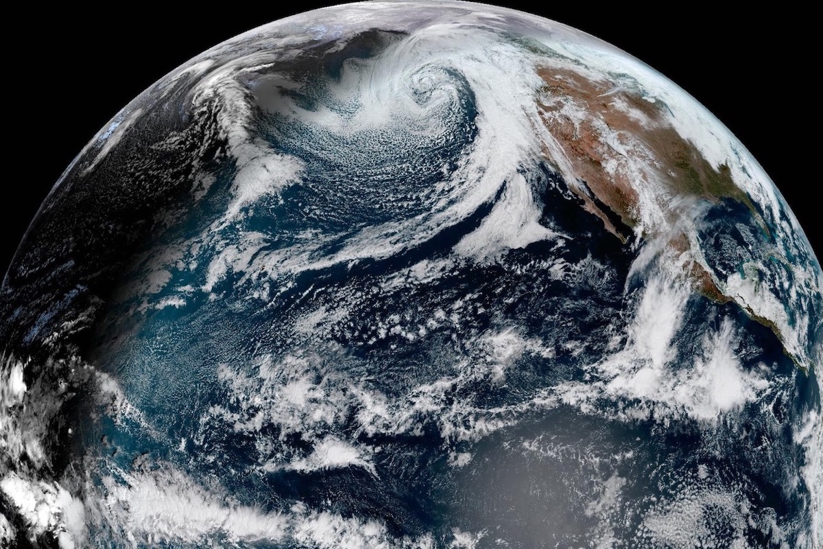
The forming storm is being driven by a cyclone rotating from the Gulf of Alaska to the Hawaiian islands, likely to bring the county’s coastal mountains and valleys as much as three to five inches during the early Thursday downpour, with the possibility that rain will fall a half-inch per hour at times. Roads and creeks could be flooded if the 10-20 percent chance for thunderstorms brings flashes of heavy rainfall.
West-facing beaches from Santa Barbara to Los Angeles, including at Catalina and Santa Barbara islands, could see eight- to 12-foot waves, with the largest waves locally predicted for Ventura at 15 feet. Rip tides and large waves increase the dangers of drowning if they catch unsuspecting surfers, beach-goers, jetty-walkers, or boaters unawares, the NWS warns.
As well, the storm may bring as much as a foot of snow above 7,000 feet, and down to 4,000 feet by Friday morning across Southern California.
By Sunday, a two- to three-day storm begins to gather. The National Weather Service is calling this one a “serious” storm for the South Coast, though the computer models are currently in conflict. The possible four to eight inches of rain along south-facing mountains would be heavy enough to cause mud and rock slides, and flooding of downstream areas. Snowfall could be significant down to 4,000 feet into next Wednesday.
The county shared the following tips and resources to help residents safely weather the storms:
Take Action to Stay Safe During the Storm
- Stay away from rivers, creeks, streams, and other low-lying and flood-prone locations
- Monitor changing weather conditions and adjust your driving plans
- Stay off the roads during peak rain times
- Maintain awareness of personal safety as conditions can change quicklyIf you live in a flood-prone area, anticipate significant flooding and the potential for isolation
- Ensure you’re registered for emergency alerts at ReadySBC Alerts – Sign up (everbridge.net)
Resources
- For status of highways: https://roads.dot.ca.gov/roadscell.php
- For status of County roadways: https://www.countyofsb.org/2116/Road-Closures
- For County sandbag filling locations: https://www.countyofsb.org/2219/Sandbags
- Detailed weather forecasts are available at www.weather.gov/lox
- For more information on how to prepare for and stay safe during winter storms and flooding, visit https://www.readysbc.org/576/Storm-Readiness.


