Whose Land Is It Anyway?
UCSB Accused of Building Without a Permit

While UCSB’s projected growth through 2025 has rankled more than a few community members, the university has also completed some smaller developments not yet approved as part of its Long Range Development Plan (LRDP). UCSB officials deny any wrongdoing, but critics of these moves say the school likely preferred that the work went unnoticed.
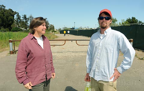
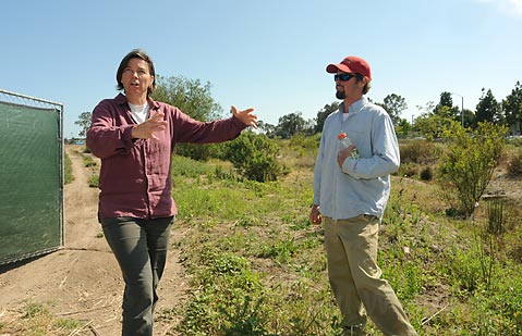
UCSB currently is facing alleged violations from the California Coastal Commission (CCC) for building without a permit. Pat Veesart, enforcement supervisor with the CCC’s Ventura branch, confirmed that the organization, after receiving documents from an anonymous source, sent the university a letter in August 2008 about the unpermitted development. The development occurred on the East Storke Campus area, behind Harder Stadium. The violations in question include the installation of two steel gates, construction of a concrete driveway and apron, creation of a graveled road, burying of sewer and/or drain lines, and construction of a culvert-all of which are located within an alleged wetland and wetland restoration area.
Marc Fisher, UCSB’s senior associate vice-chancellor and campus architect, dismissed the allegations as the result of a misunderstanding. “[The road] does not go through a wetland. It goes through the edge of a storm drain that was built by us. So it’s a definitional issue, and the thing that is nearest is actually a human-made structure designed to hold storm water. It did not in any way touch a wetland,” he claimed. “It’s an allegation. : You know, innocent until proven guilty.”

Some sources contacted for this story were not able to say whether the land constituted a wetland. “The situation is, of course, more complicated than a yes-or-no answer,” explained Lisa Stratton, natural areas director at UCSB’s Cheadle Center for Biodiversity and Ecological Restoration. She said the area is not part of a delineated wetland according to the most recent assessment, commissioned by the university in 2000 through environmental consulting firm Padre Associates. “The university has been working with that delineation in making its decisions,” Stratton explained.
Brian Trautwein, an environmental analyst with the Environmental Defense Center, gave a different opinion. “Given the plant species and their distribution as well as the soil types present, this looks very much like a wetland habitat, and I think further testing would reveal that this is in fact a wetland,” Trautwein declared after visiting the site. According to the federal definition of a wetland as stated by the Army Corps of Engineers, an area is considered one if it meets three criteria: the correct hydrology pattern, the type of soil present, and the plant species growing in the area. However, in the coastal zone where Santa Barbara lies, only one of these indicators is needed to designate an area as wetlands. Trautwein said the fact that plants such as California bulrush and bristly ox-tongue are growing in the area could be enough to include this plot of land under the classification.
Looking at an aerial photo of the site reveals the bigger picture. “This area connects to the Storke Wetlands, which then drains into the Goleta Slough, which is an important preserve,” Trautwein explained. “Any restoration of the wetlands in this area here will have great benefits for the Goleta Slough downstream.” Trautwein explained that an interconnected network of wetlands was better than isolated pockets because the former would reduce water pollution and flooding and would enhance the habitat for native flora and fauna. As he explained it, major pollutants like car oil and grease will be better filtered if they flow through an extensive wetland system.
Trautwein said the problem with the road constructed and pipe buried by the university prior to obtaining CCC permission is that both projects create unnatural barriers to this filtration system. Photos of the site taken in 2005 prior to this mid-2008 development show the only existing road as a narrow footpath that allowed water to drain normally between wetlands.
Another concern of Trautwein’s is that any construction done in a wetland area is required by the Coastal Act to have a buffer of at least 100 feet between itself and the sensitive area. The development completed is within the 100-foot buffer of the already delineated Storke Wetland. But if the smaller wetland were to be designated officially, the road and pipe would run straight through a wetland with nothing close to such a buffer. Trautwein explained this is a concern because the close proximity of the construction can lead to sediment build-up that clogs the wetland and degrades its ability to filter and absorb runoff.
Trautwein said he hoped the university would use the situation to engage the community, possibly through a volunteer program aimed at restoring the wetland in question and connecting it to its neighboring bodies. Especially helpful, Trautwein noted, would be connecting the San Clemente Mitigation Project, which is a project funded by the university to address water quality and flooding impacts created by the San Clemente Graduate Housing to another disputed wetland.
Whether unpermitted construction occurred in a wetland is not the only issue at hand; according to Veesart, that anything was built prior to receiving CCC permission is also a problem. “The issue of it being in a wetland affects whether the commission would approve the development, but the bottom line is it is development, according to Chapter 9 of the Coastal Act, and it needs to be in [UCSB’s] LRDP,” Veesart explained. “They should have submitted the NOID [Notice of Impending Development] prior to construction. And now they are doing it after the fact, so they could be subject to penalties, but it’s not likely.”
The university has submitted its response to the CCC, stating that it does, in fact, plan to resolve the alleged violation by filing an after-the-fact NOID, which the CCC would then consider for approval. Fisher, who is overseeing the development of the physical aspects of the current LRDP, maintained his belief that UCSB has done nothing wrong. “I don’t believe that anything in this is ‘illegal.’ The apron and gates were permitted through the County of Santa Barbara. : The road was a pre-existing condition and has been in this location for many years and certainly prior to the 1990 LRDP.” However, when June Pujo, a Santa Barbara County planner, was asked about permitting the developments, she had no record of such an interaction. “The area is outside of the county’s jurisdiction. We don’t have any records that I could find at the county on this,” Pujo stated.
While it remains to be seen how UCSB’s allegedly unpermitted work will be dealt with, critics claim such missteps raise bigger questions about exactly which entity should ensure that UCSB follows the rules, especially when the development in question is happening on land that UCSB owns. All things considered, Fisher said the present matter is being properly addressed and will be resolved. “The Coastal Commission is working diligently with our staff to sort this out. There are overlapping jurisdictions and an evolved solution that is being considered,” he said.


