Potential Evacuation Challenges for Santa Barbara and Goleta During Extreme Wildfire Conditions
Road Projects Blocking Exits and Impacting Highways Could Compromise Evacuation

I am a meteorologist and climate science professor at UC Santa Barbara who has studied Sundowner winds and fire weather for more than a decade. And I’ve grown increasingly concerned about our ability to evacuate large areas of southern Santa Barbara County given the region’s ongoing infrastructure projects.
Since the fall 2024, Southern California has faced a devastating onslaught of wildfires that have captured global attention and sympathy. While Californians are familiar with the threat of wildfire, the sheer scale and flurry of the Mountain, Palisades, and Eaton fires — striking within a span of less than three months — have left a mark on our history as well as our landscape.
Most crucially, these events have served as a resounding wake-up call, illustrating our unpreparedness to tackle wildfires under extreme conditions. These incidents have caused a paradigm shift in wildfire science, revealing that defenses such as agricultural buffers, home hardening, and prescribed burns can be thwarted by the ferocity of hurricane-strength winds.

Fire weather refers to atmospheric conditions that are prime for fueling wildfires. These include fierce winds, very low humidity, and unseasonably high temperatures. Southern California often grapples with extreme fire weather during Santa Ana wind events. The region’s lack of precipitation — following an intensely hot summer marked by numerous heat waves — has led to perilously low fuel moisture in fall 2024 and winter 2025. These compound events have created a perfect recipe for extreme fire-related disasters.
All major wildfires in coastal Santa Barbara County’s history, without exception, have been linked to gusty and dry Sundowner winds blowing from the Santa Ynez Mountains. While the Thomas Fire initially raged under strong Santa Ana winds, it spread toward Montecito when these winds weakened and the eastern Sundowners took over.
The greatest issue with Sundowners is their variability, which causes uncertainty regarding which regions should evacuate, how quickly, and for how long. Therefore, once a Particularly Dangerous Situation is issued by the National Weather Service, fire agencies need to act swiftly.
Sundowners occur year-round but are typically more frequent from March to May. The Jesusita Fire occurred in May 2009. Although less frequent, Sundowner events during summer are potentially the most destructive.

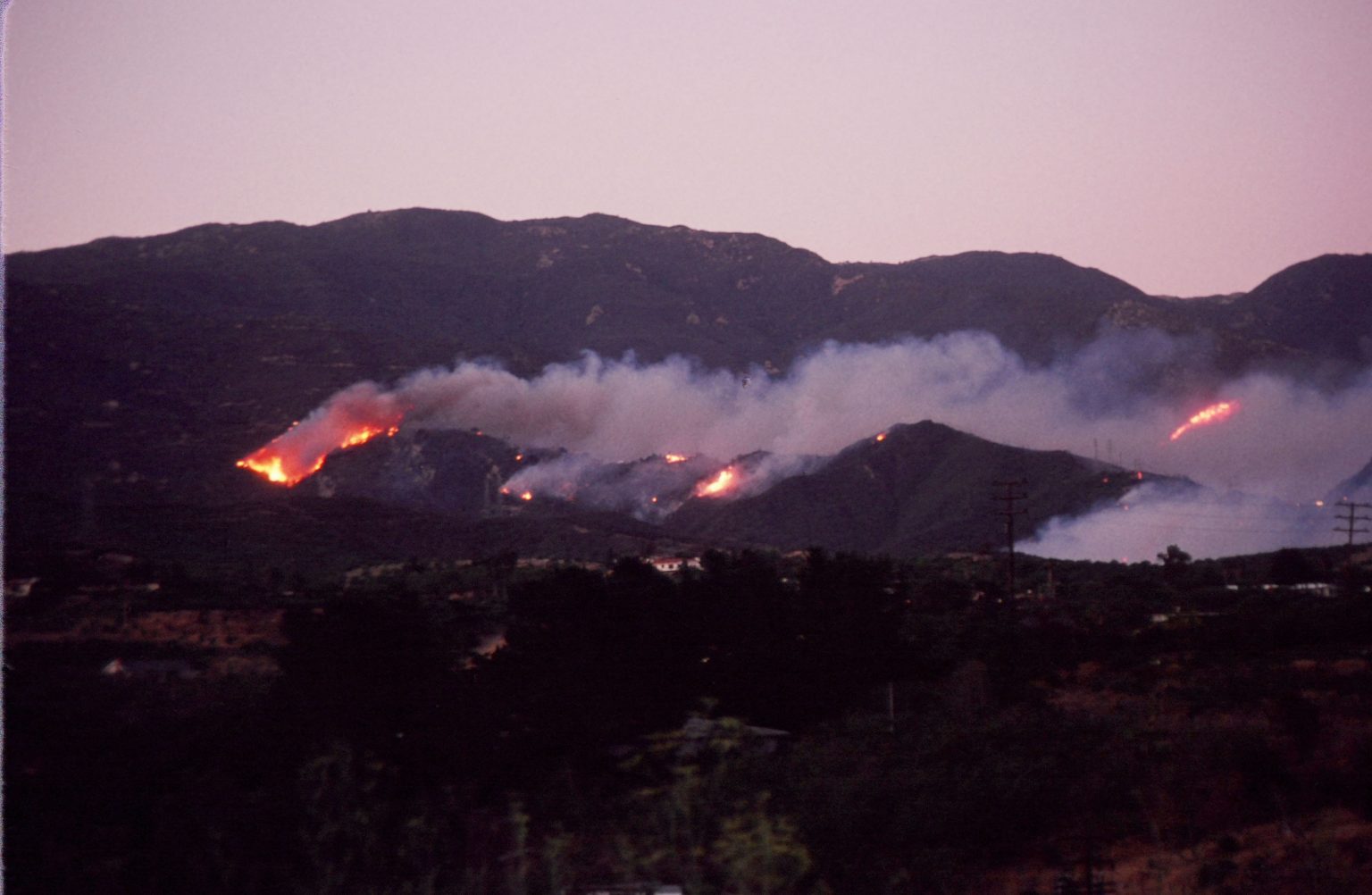
Residents who have lived in the area for more than three decades may recall the devastating Painted Cave Fire of 1990. On June 27, at 6:02 p.m., a brush fire was reported on Highway 154 and Painted Cave Road. This incident, attributed to arson, occurred during extreme Sundowners and temperatures exceeding 109° F.
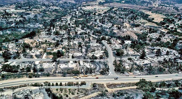
The terror that followed has been documented in newspapers and accounts from the local community and firefighters. Reports and images from the incident, such as the destruction of homes south of the US-101, remind us that wildfires have spread to neighborhoods far from the foothills, and may again. Among the most concerning images and reports were those describing the chaos during evacuation: People did not know where to go, exits became clogged, and some even evacuated on foot.
What would happen if a similar situation occurred today?
Ongoing road construction and new projects have been strangling traffic for months in south Santa Barbara County, and perhaps will continue to do so for years. For example, the remodeling of Hollister Avenue in old Goleta — intended to facilitate parking by reducing the already narrow street to one lane — has further compounded the issue. Hollister Avenue is one of the most crucial conduits for traffic to and from densely populated communities. Additionally, constructions have reduced to one lane both sides of the State Route 217, which connects UCSB and the Santa Barbara Airport to the U.S. 101. These constructions have impacted traffic flow for more than a year.
This winter has been excessively dry for most of Southern California. Even if we get one or two significant rainfall events that keep the region out of severe drought, these may simply enable more fuel to build up. Meanwhile, parts of the southern Santa Ynez Mountains have not burned for decades, and the expected increase in heat waves driven by climate change will create conditions for more destructive fires.
I have built a solid and respectful relationship with meteorologists at the National Weather Service, and with fire marshals and wildland fire specialists at the Santa Barbara County and Montecito Fire Departments. Given my background, I believe that county and city decision-makers need to prioritize evacuation safety. Road construction blocking exits, and those that significantly impact freeways and highways, should be considered a budget priority so it can be completed as quickly as possible. In the meantime, traffic patterns around this construction should be reconsidered in light of evacuation needs.

You must be logged in to post a comment.