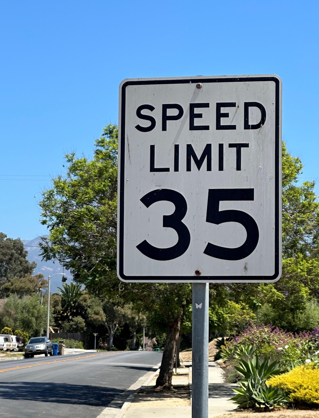
Big cars with bumpers 40 inches in the air, drivers who text, inebriation, and speeders have all contributed to an increase in pedestrian deaths nationwide, speakers told the Goleta City Council as it prepared an ordinance to reduce speeds along most of the city’s major roads by 5-10 miles per hour. New signs with new speed limits will be going up in January. The ordinance went into effect in October, and Goleta police will be giving warnings for the first 30 days they’re up and citations after that.
Mayor Paula Perotte, who has long championed safe routes to schools, said she had to hold back her excitement as the council voted for the measure: “Traffic surveys, they’ve always made me cringe, because it usually meant the speed would go up.”
A traffic survey of actual road speeds used to be how posted speeds were determined. A new state law — Assembly Bill 43 — uses those surveys but changed the way speeds can be determined. Speeds can now be rounded down by 5-10mph depending on criteria like high rates of accidents or proximity to schools or businesses.

Residents who take Calle Real between Glen Annie and Brandon Drive reported regular near misses due to drivers’ high speeds on a road that is currently posted 45mph. In fact, a bicyclist died after being struck by a car in April 2020. During the investigation that night, a patrol car blocking the road was hit by another car.
The 1.2-mile section of Calle Real is a well-used corridor for kids and parents headed to and from Dos Pueblos High School and Brandon Elementary. Neighbors tell stories about cars “bumping” e-bikes and injuries narrowly avoided. Some blame the visibility of the 101 through the chainlink fence, which gives Calle Real drivers the illusion that they, too, can drive at highway speeds. Others say it’s the curve in the road plus the many side streets that make it hard to see oncoming cars.
“It’s a really dangerous road,” said Jennifer Smith, who was elected to the council in November and took her place on the dais December 17. “It’s dark at night, people who are pulling out from side streets, because of the way the road turns, it feels like you’re just saying a prayer pulling out.”
That section of Calle Real will see the posted speed drop from 45 to 40 mph. Perotte noted that the city depended on its three motorcycle patrol officers for enforcement of the new rules and that the city was advocating to bring on a fourth.

Other streets soon to see lower speed signs are Cambridge Drive, Cathedral Oaks Road, Covington Way, Encina Road, Fairview Avenue, Glen Annie Road, Hollister Avenue, Kellogg Avenue, La Patera Lane, Los Carneros Road, Pacific Oaks Road, Patterson Avenue, Phelps Road, Storke Road, and Ward Drive. The staff report listing roads and speeds can be found here: https://tinyurl.com/ujymur.
SANTA BARBARA COUNTY
The County of Santa Barbara made a similar decision at the supervisors’ November and December meetings, slowing speeds by 5mph in parts of Orcutt, Alamo Pintado in Santa Ynez, the Eastern Goleta Valley, and Via Real between Summerland and Carpinteria. The roads affected are:
FIRST DISTRICT
Mission Canyon Road from the Santa Barbara City Limits to State Route 192
San Ysidro Road from State Route 192 to Jameson Lane North
Sheffield Drive from Jameson Lane North to State Route 192
Via Real from 800 feet west of Toro Canyon Road to the Carpinteria City Limits
SECOND DISTRICT
Modoc Road from Via Senda to City of Santa Barbara (from 50 mph to 40 mph)
Calle Real from San Marcos Road to Old Mill Road
Camino Corto from El Colegio to Abrego Road
Cathedral Oaks Road from the Goleta City Limits to Turnpike Road
El Colegio Road from Storke Road to the University of California, Santa Barbara boundary
Hollister Avenue from the Goleta City Limit to Modoc Road
Las Palmas Drive from Via Senda to Via Benita
Marina Drive from Roble Drive to the Santa Barbara City Limits
Modoc Road from Encore Drive (East) to Via Senda
Nogal Drive from Vieja Drive to Hollister Avenue
Patterson Avenue from Shoreline Drive and the Goleta City Limits
Patterson Avenue from the Goleta City Limits to Cathedral Oaks Road
San Marcos Road from Calle Real to Cathedral Oaks
State Street from Modoc Road to the Santa Barbara City Limits
Turnpike Road from Hollister Avenue to Cathedral Oaks Road
THIRD DISTRICT
Los Olivos Elementary School (Alamo Pintado Avenue – from 25 mph to 15 mph)
Alamo Pintado Road from the Solvang City Limits to Santa Barbara Avenue
Edison Street from Tivola Street to 200 feet north of Baseline Avenue
San Miguelito Road from the Lompoc City Limit to 8722 feet south of the Lompoc City Limit
Santa Barbara Avenue from Alamo Pintado Road to Alamo Pintado Avenue
FOURTH DISTRICT
Bradley Road from Santa Maria Way to Patterson Road
Broadway from Rice Ranch Road to California Boulevard
California Boulevard from Broadway to the Santa Maria City Limits
Clark Avenue from State Route 1 to El Portal Street
Lakeview Road from Orcutt Road to Bradley Road
Orcutt Road from Lakeview Road to Rice Ranch Road
Rice Ranch Road from Broadway to Bradley Road
Rucker Road from Purisima Road to Calle Lindero
Union Valley Parkway from Bradley Road to U.S. 101 Northbound Ramps
A map of the affected county roads can be found here: https://bit.ly/SBCSpeedLimit2024.
Premier Events
Fri, Jan 09
5:30 PM
Santa Barbara
Intention Setting & Candle Making Workshop
Sun, Jan 11
3:00 PM
Santa Barbara
Mega Babka Bake
Fri, Jan 23
5:00 PM
Santa Barbara
Divine I Am Retreat
Fri, Jan 09
8:00 AM
Santa Barbara
Herman’s Hermits’ Peter Noone: A Benefit Concert for Notes For Notes
Fri, Jan 09
6:00 PM
Santa Barbara
Ancestral Materials & Modernism
Fri, Jan 09
6:00 PM
Montecito
Raising Our Light – 1/9 Debris Flow Remembrance
Fri, Jan 09
7:00 PM
Santa Barbara
Barrel Room Sessions ~ Will Breman 1.9.26
Sat, Jan 10
9:00 AM
Santa Barbara
Rose Pruning Day | Mission Historical Park
Sat, Jan 10
7:00 PM
Santa Barbara
Konrad Kono – Live in Concert
Sat, Jan 10
8:00 PM
Santa Barbara
SB Improv: The Great Cornadoes Bake-Off
Mon, Jan 12
5:00 PM
Santa Barbara
Hot Off the Press: Junk Journal
Tue, Jan 13
6:00 PM
Santa Barbara
✨ First Singles Social of 2026 | Open to All Ages 21+
Fri, Jan 16
9:00 PM
Santa Barbara
Eric Hutchinson at SOhO
Fri, Jan 09 5:30 PM
Santa Barbara
Intention Setting & Candle Making Workshop
Sun, Jan 11 3:00 PM
Santa Barbara
Mega Babka Bake
Fri, Jan 23 5:00 PM
Santa Barbara
Divine I Am Retreat
Fri, Jan 09 8:00 AM
Santa Barbara
Herman’s Hermits’ Peter Noone: A Benefit Concert for Notes For Notes
Fri, Jan 09 6:00 PM
Santa Barbara
Ancestral Materials & Modernism
Fri, Jan 09 6:00 PM
Montecito
Raising Our Light – 1/9 Debris Flow Remembrance
Fri, Jan 09 7:00 PM
Santa Barbara
Barrel Room Sessions ~ Will Breman 1.9.26
Sat, Jan 10 9:00 AM
Santa Barbara
Rose Pruning Day | Mission Historical Park
Sat, Jan 10 7:00 PM
Santa Barbara
Konrad Kono – Live in Concert
Sat, Jan 10 8:00 PM
Santa Barbara
SB Improv: The Great Cornadoes Bake-Off
Mon, Jan 12 5:00 PM
Santa Barbara
Hot Off the Press: Junk Journal
Tue, Jan 13 6:00 PM
Santa Barbara
✨ First Singles Social of 2026 | Open to All Ages 21+
Fri, Jan 16 9:00 PM
Santa Barbara








You must be logged in to post a comment.