Lake Fire 90 Percent Contained
Santa Ynez Valley Gets Back to Business as Usual, Though Evacuation Warning and Orders Still in Effect for Some Areas
The skies over the Santa Ynez Valley have cleared of smoke and ash as firefighters have tamed 90 percent of the Lake Fire as of Monday, July 22.
Business was back to usual, said Tracy Beard with the Solvang Chamber of Commerce. “Two Wednesdays ago, the smoke lay in the valley for a couple of hours,” she said, “but the fire was 22 or 25 miles away and didn’t really affect us too much. The smoke mostly was shooting eastward.”
Beard said she had heard that business was up by 5-10 percent for some in the Solvang business community. “All the wine tasting rooms are open, and we have an extremely healthy level of tourism.”
Farther to the west in Los Olivos, which at one time lay eight miles from the fire front, business was picking up again. All the stores, wine bars, and restaurants on Grand Avenue were open, and had never really closed since the fire flared up on July 5 around Zaca Lake. Just north of Los Olivos, the wineries amid the rolling hills were also open again.
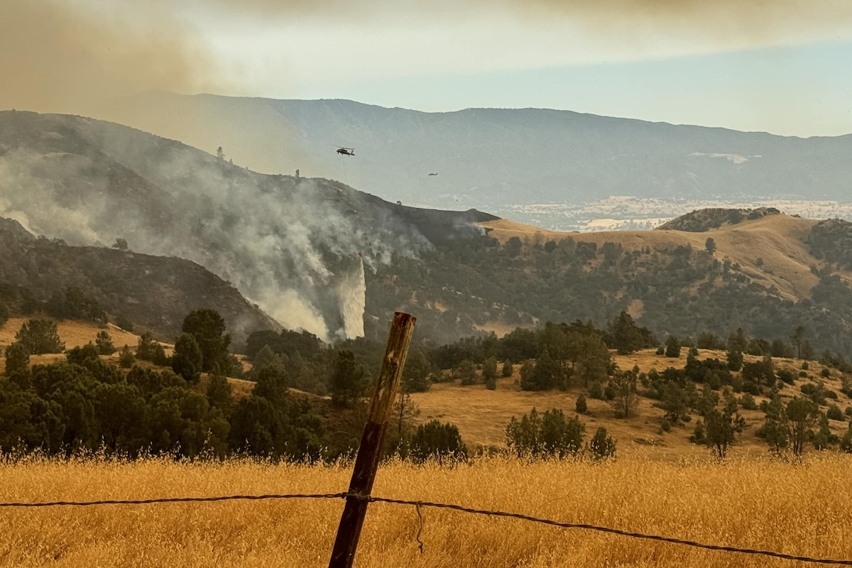
The occasional helicopter flies across the valley headed for the inner regions of the fire, now at 38,664 acres, dumping buckets of water to douse the embers. About 1,600 people are still on the fire, putting out islands of unburned vegetation by Pulaski axe, fire hoe, and chainsaw. More crews were cleaning up, removing hose lines and pump systems, as well as the fire-resistant wrap around the Dabney Cabin and Manzana Schoolhouse that had protected the historic structures. Roads and fire lines were under repair, including the contingency lines that stretched toward Cuyama, set when the fire was thought capable of running rapidly to the north.
The remaining areas under evacuation orders are the fire footprint itself, as well as the area between the Sisquoc River and the boundary of Los Padres National Forest, from La Brea Creek to Forest Route 10N06. The only area under an evacuation warning is the western border of the fire to Kelly Canyon.
For the latest information on the Lake Fire response and recovery, see readysbc.org. To view the evacuation map, click here.