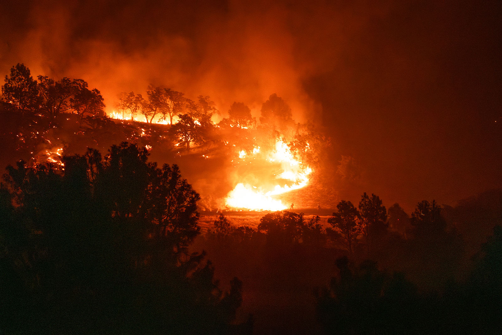
Santa Barbara County Expands Lake Fire Evacuations Again on Tuesday Afternoon
Update: Evacuation Orders and Warnings Expand; Fire Has Spread Toward Edge of Santa Barbara County’s Wine Country

[Update: July 9, 2024, 5:20 p.m.] The Lake Fire grew to 26,986 acres Tuesday afternoon and remained at 12 percent containment, according to Cal Fire. In addition, a new road closure has been announced on Calzada Avenue at Roblar Avenue, while the closure on Figueroa Mountain Road has been moved to half a mile from Highway 154. Highway 154 itself remains open. A map of all county road closures can be found here.
[Update: July 9, 2024, 1:30 p.m.] As predicted, the Lake Fire has grown aggressively, and a new evacuation order was added for the Lake Fire on Tuesday afternoon. The full evacuation area is best viewed on the map created by emergency services, on which addresses can be plugged in to see if they’re in the evacuation order or warning zones.
- The previously issued Evacuation Warning has been upgraded to an EVACUATION ORDER for the Woodstock and Goat Rock areas due to Lake Fire. Additionally, an EVACUATION ORDER has been issued for the S.B. Ranger area (remote forest area east of Goat Rock). Leave the area immediately.
Additional evacuation warnings are now in place:
- Area east and north of Alisos Rd (L-shaped road), west of Cachuma Creek, and south of the US Forest Service entrance at Happy Canyon Road.
- Area east of Highway 154, north of Armour Ranch Road/Secretariate St, west of Alisos Rd, and south of the Woodstock area.
- Area east of Figueroa Mountain Road, north of Highway 154, west of Calzada Ave/W Oak Trail Rd and south of Woodstock Rd.
[Original Story] Fire helicopters flew at night on Monday ahead of red-flag conditions — gusty winds, high heat, and low humidity — expected in the Lake Fire area on Tuesday, concentrating on two populated areas northeast of Los Olivos, Sedgwick/Brinkerhoff and Happy Canyon, Anthony Stornetta reported to the Santa Barbara Board of Supervisors Tuesday morning. Stornetta, county fire’s deputy chief of operations, said that Cal Fire helicopters were likely to fly Tuesday night to protect the ranchette-sized parcels, homes, and outbuildings that dot the roads amid the foothills.
At the moment, however, the fire was high up on the hill and backing down slowly. To the east, it was sparking into the San Rafael Wilderness.
So far, one structure in Los Padres National Forest was confirmed damaged in the fire, which started on July 5 near the Zaca Lake Resort.
The Lake Fire — measured at 26,178 acres and 12 percent containment on Tuesday — is burning into the old Marre Fire footprint from 1993, as well as the 240,000-acre Zaca Fire from 2007, but the southern area near Michael Jackson’s Neverland Ranch and Los Olivos is not known to have burned before. The area has grown from pasture lands to Arabian horse country to the edge of Santa Barbara County’s wine country. In his remarks, Stornetta added that they hoped to be able to lift the road closures to the area’s wineries once the fire lines were secure, as they understood the businesses wanted to reopen again.
Wine Country Impacts
Most wineries and tasting rooms in the Santa Ynez Valley have not been physically impacted by the fire, aside from smoky skies. The flames did get fairly close to Star Lane Vineyard, which sits below Figueroa Mountain.

On Monday, winemaker Tyler Thomas told the Independent that most of their workers had been moved to another facility to be free from any smoke and that Cal Fire crews had come on the property to create a fire break.
“They seem quite confident,” said Thomas, who was grateful that the fire wasn’t moving with “catastrophic” speed. “Thankfully, we had just repaired some of the mountain roads after this last season’s storms so access is good from our property.”
On Tuesday morning, Thomas reported, “Things were in great shape this morning and overnight. Smoke stayed out of the vineyard with westerly breezes.” He even rode his bike to the winery, and said the skies were clear all the way in.
“About half the fire crew has left, which we take as a good sign,” said Thomas. “With westerly winds forecast this afternoon, albeit gusty ones, we expect smoke to remain clear of the vineyard. We are very optimistic today that, if the winds remain out of the west or northwest as is common for us this time of year, we should be fine.”
The lingering concern for vintners is that wildfires like this can affect growing wine grapes, leaving aromas and flavors known as “smoke taint” in the finished wines. Most research suggests that smoke taint mainly occurs after the grapes have gone through veraison, when they change color from green to gold or red. Santa Ynez Valley vineyards are a few weeks away from that point in the season, so the smoke taint concerns are measured for now.
“At this point, we know we have seen worse vis-à-vis smoke exposure in 2016 with the Rey Fire with no impact on our grape quality,” said Thomas. But as a precaution, he sprayed an organic application called kaolin clay on the vines this week. “It has been shown to mitigate the presence of volatile compounds from smoke,” he said, explaining that it washes off easily and is also used by vineyards to deter wildlife.
Red Flag Weather Ahead
Conditions were fairly intense on Monday, with Stornetta reporting to the supervisors a temperature of 86 degrees at 11 p.m. and 6 percent humidity, which is exceedingly low. About 2,500 personnel were on this fire, as were 195 fire engines, 70 hand crews, and 11 helicopters. The plan of attack was to develop a series of lines between the fire and the homes, and to complete securing the Sisquoc drainage in the north. Already, the southwest portion of the fire was secure. Todd Hopkins, a battalion chief with Cal Fire, said the Watershed Emergency Response Team (WERT) were on the scene, examining vegetation losses and burned soil ahead of next winter’s storms.
In reply to a question from Supervisor Joan Hartmann, whose 3rd District contains most of the fire, Stornetta said the best place to get weather information and alerts is the National Weather Service website. As far as evacuation warnings, they were always a good signal to get your stuff ready to go, and even to go before the evac order is issued. Hopkins noted an early departure was the best way to avoid conflicts with incoming equipment.
For the many farmers and ranchers in the area, noted Supervisor Bob Nelson, whose 4th District is also aflame, the Ag Pass program allows them to tend their crops and livestock, as well as provide information to emergency personnel about access roads and water. The program runs 7 a.m.-9 p.m. and can be reached by phoning (805) 681-4030 or applying to https://www.countyofsb.org/293/Ag-Pass.
Roads into Los Padres National Forest are closed, as is Old San Marcos Road. State Route 154 is currently down to one lane, but in the unlikely event an unanticipated evacuation sends residents fleeing toward San Marcos Pass, Caltrans will make the signal one way going downhill.
For the latest on evacuation and helpful information, visit ReadySBC.org.
Fire Preparedness Report
Tuesday’s Board of Supervisors hearing ended with a report from County Fire and the local Fire Safe Council on the work they’ve been doing to prevent fire spread. This includes fighting fire with fire, Fire Marshal Fred Tan said, as well as keeping roadside vegetation low, which is where most fires start. Defensible space in urban areas and around homes were also a part of about $13 million in Cal Fire grants.
These were also a major focus of the Fire Safe Council, said executive Director Anne-Marie Parkinson. The nonprofit now has six employees who work to educate the community on home hardening and defensible space, hold chipping days, graze herds of sheep, and work with Spanish-speaking homeowners through about $16 million in grants for high- and low-risk areas.
“Fire is a community-scale risk,” Parkinson said. “Fire agencies can’t guarantee they can get everyone out” in an emergency, she added. “The community needs to do their part and be part of the solution.”


![Lompoc Opts Out of Wine Country [Corrected]](https://www.independent.com/wp-content/uploads/2025/01/Lompoc_Scenic_Hills_Vineyards_JeremyBall.jpg?resize=850%2C530)


You must be logged in to post a comment.