What’s the Likelihood of Another Debris Flow?
Much Remains in All Burn Zones but Movement Depends on Many Factors

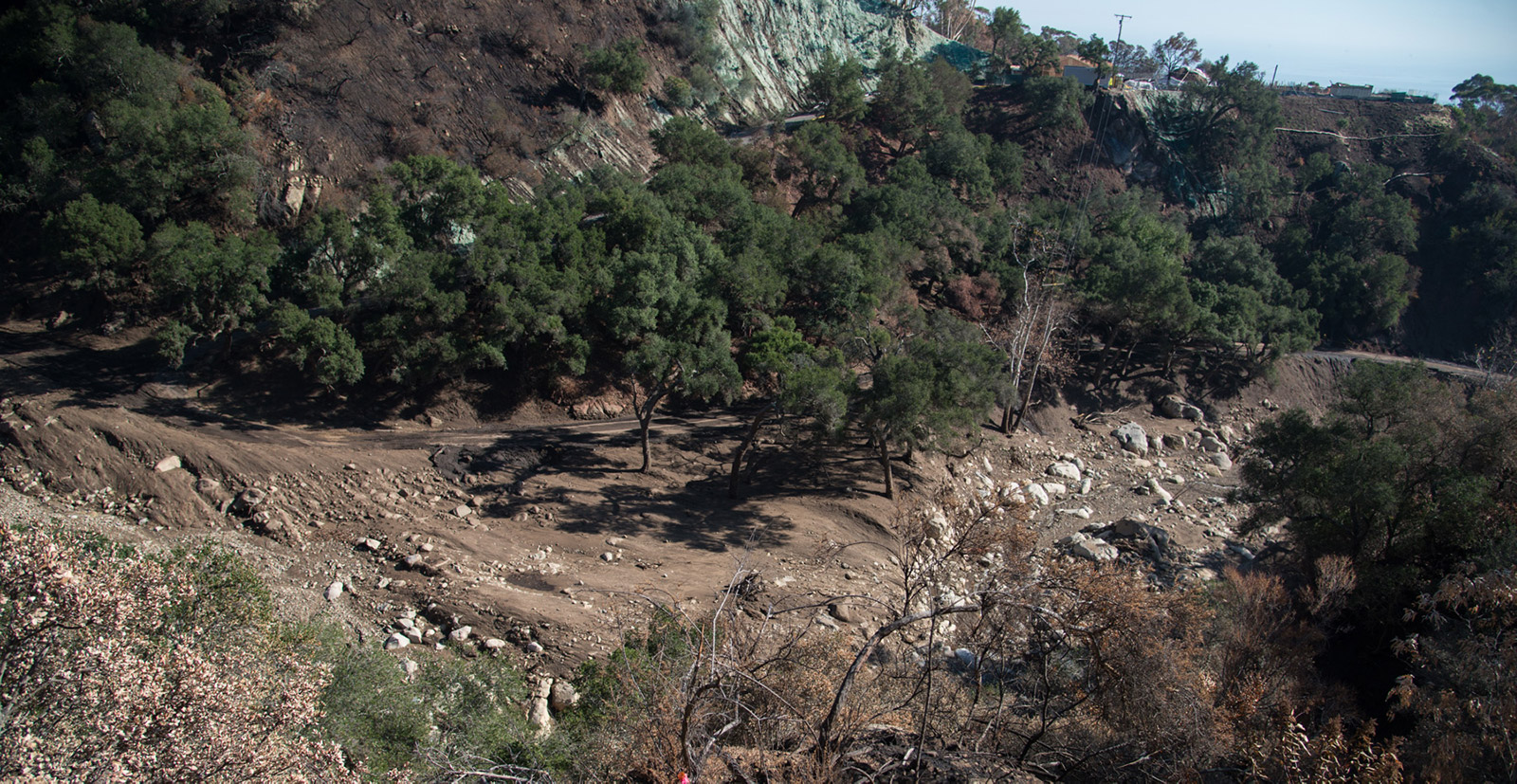
The weather forecast for the week is clear and sunny, an enviable prediction anywhere but drought-plagued California. But if it ever rains again in Santa Barbara, be assured, it’s entirely possible a repeat of the terrible mudslides could occur, say the experts. The rains of January 9 brought down millions of tons of sediment that ranged in size from sand particles to bus-sized boulders, but more remains in stream channels and hanging off vertical walls left behind by the high velocity of the debris flow.
“Everyone has a clear idea now of what a debris flow can do,” said Kevin Cooper, a wildlife biologist and climate change unit coordinator with the U.S. Forest Service. “Those can unfortunately happen again in the same drainages.” Cooper is one of the contributors to the BAER (Burn Area Emergency Response) report, the first draft of which came out in mid-January. The multi-agency group, along with the state’s Wildfire Emergency Response Team (WERT), has been looking at conditions in Montecito’s canyons post-Thomas flood, evaluating future potentials. Cooper was also part of the BAER teams that conducted research on Whittier and Sherpa fires the past two summers.
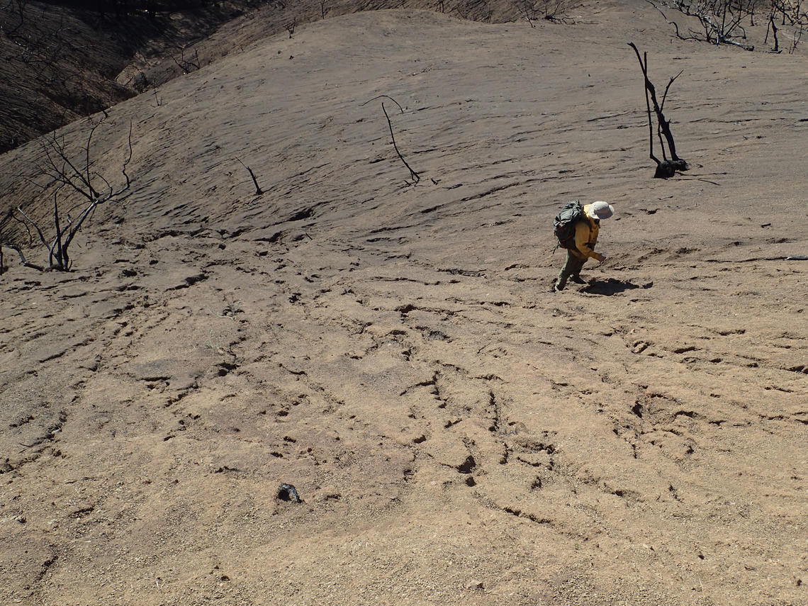
Comparing the conditions he saw in Cold Spring Canyon, where greenery is just beginning to repopulate the soil, “Sherpa has had a year to grow back,” Cooper observed, “but the upper slopes are rockier, and there’s still a lot potential for debris to move” should a massive rain recur there. In Cold Spring Canyon, moisture and a lot of soil still remain, which is good for the seedbank and active root systems. As for the Whittier burn scar from July 2017, it’s an “extremely steep and hazardous area on both the north and south sides” of the Santa Ynez range, Cooper said. Though the additional moisture on the leeward side means vegetation has sprouted more vigorously, “the soil is still exposed and very loose,” he said. That exposure has also revealed historic and extremely large debris flows, Cooper said, “visible all the way to Cachuma Lake.”

While the BAER team investigates conditions on national forest lands, the state WERT looks at state-responsibility lands. The WERT group’s Len Nielsen, a forester with Calfire, explained that in an area like Carpinteria, which has similar geology to Montecito though more of a green belt between the hills and the city, the amount of the watershed that burned was significant. It’s still possible a flood event could be “very bad,” Nielsen thought, “or very, very bad.”
Part of the teams’ work involves looking at “pour points.” These are spots from which hydrologists can look upward to see how the rain might course and downward to see where it might end up. Unlike deeply incised channels in canyons or valleys, where the flow of water is limited, on a debris fan, said Cooper, when the rain rolls off ridgelines, the possibilities expand as to where the water can go. Those possibilities, and potential downstream blockages, form part of the hydrology section of the WERT report, which is still being written. This report is of deep importance in obtaining project funding, from an agency like FEMA, for instance, as it reviews what structures are at risk, what remains to be done, and what to expect from the next storm.
As before, Cooper said, a storm delivering 28mm per hour, or about 1.1 inches, could trigger another round of flooding and debris flows. Such a rain can affect even older burn scars, like 2016’s Sherpa or Rey, as it can take three to five years for the vegetation to recover. “Even if it doesn’t hit straight on,” Nielsen added, “or comes from another direction, what matters is the amount of rain that falls.”
Whether there will be a next storm this year could be in doubt. Daniel Swain, as a post-doc at Stanford, coined the term “ridiculously resilient ridge” to describe the stubborn band of high pressure stretching from the Gulf of Alaska to Northern California and blocking winter storms since 2013. Now a fellow at UCLA’s Institute of the Environment & Sustainability, he said the high pressure ridge bringing the current warm weather is again amazingly resilient. Normally, a forecast can’t be made with confidence beyond a week or two. “An inside slider could come down the east side of California,” Swain said, “and bring some showers,” but the high pressure ridge is so stable that he felt the seasonal forecast of dry and warm has an “elevated likelihood” of hanging around even into March.
But, as any weather system nears, the accuracy of its predictability improves. Should another heavy rain appear in the forecast, “Listen to officials,” Nielsen said. “Don’t be a do-it-yourselfer.”
Editor’s Note: This article was corrected on February 6 to indicate rainfall measurements are in millimeters, not milliliters, and the resulting inch change.


