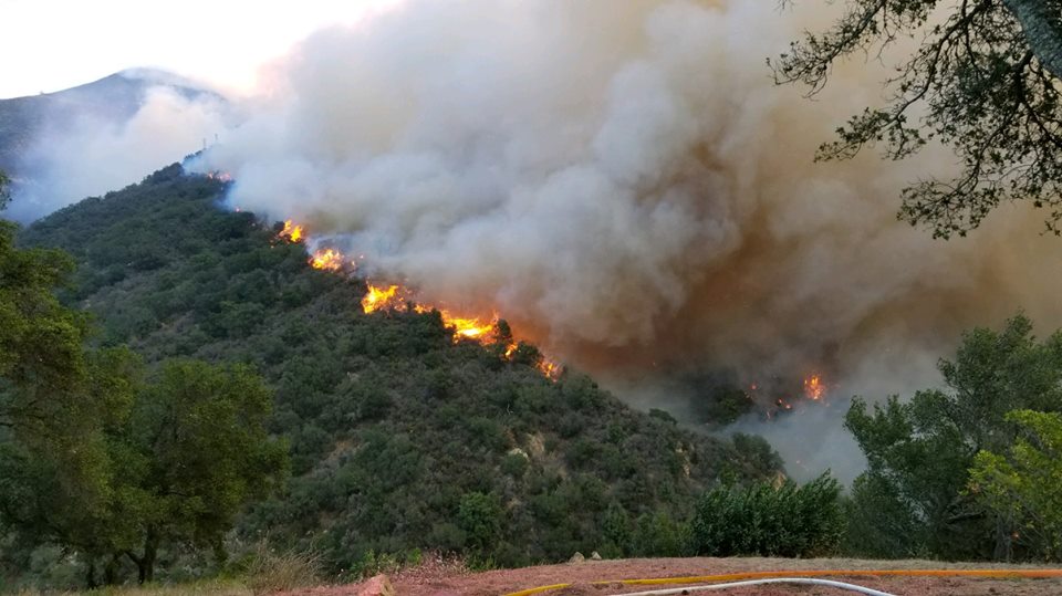
[Update: Dec. 16, 11:41 a.m.] Sheriff’s deputies are reporting fire around Ashley Road in Montecito, directly south of East Mountain Drive and east of Westmont College. Despite fire burning in that area, throughout the Montecito foothills, and now towards Gilbraltar Road, County Fire spokesperson Dave Zaniboni is reporting that no structures have been lost in this morning’s firefight. “It’s been a true firefight out here today,” Zaniboni said.
New mandatory evacuation orders were issued for south of Highway 192 to North of Highway 101 west of Toro Canyon and east of Summit Road and Country Club. There are reports of motorists on Highway 101 in Montecito driving against the flow of traffic, heading southbound in the northbound lanes to escape gridlock in the area.
According to Caltrans spokesperson Jim Shivers, seven ramps on Highway 101 southbound are closed to help keep circulation moving on local streets for those who really need them. He said state reports indicate 4,000 gallons of diesel spilled, causing damage to pavement and striping. (Previous reports said 8,700 gallons.) “The highway is too rough for vehicle traffic. Estimated opening is 4 p.m. to 6 p.m.,” he said. Caltrans needs to do some temporary resurfacing or patchwork, he added.
Evacuation in the Santa Barbara and Montecito areas as of 11:50 a.m. are as follows:
Mandatory evacuations (orders):
- Montecito and Summerland area north of Alameda Padre Sierra/South Salinas Street and Highway 101, south of 192, east of Mission Canyon Road, and west of Hot Springs/Summit Road.
- The area east of Hwy 154 to Mission Canyon Rd and north of 192 to East Camino Cielo.
- The area north of Highway 101, south of 192, west of Toro Canyon Road, and east of Summit Road/east of the Country Club. Residents should leave immediately.
“Residents should leave immediately,” officials said.
Voluntary evacuations (warnings):
- The area east of and including N. San Marcos Rd. to Hwy 154 and north of Cathedral Oaks Rd. to the intersection of Hwy 154 and N. San Marcos Rd (near top of San Marcos Pass).
- Voluntary evacuation warnings have been issued across downtown, north of Highway 101, and east of Highway 154.
“Residents should be prepared to leave in a moment’s notice,” officials said.
[Update: Dec. 16, 11:32 a.m.] Montecito Fire personnel are reporting that the edge of the Thomas Fire is burning just above Upper Hyde Road, which is directly north of Westmont College along E Mountain Dr. This western edge has now burned Gould Park and is racing towards Gibraltar Road, where fire crews have been preparing for about a week now, clearing additional vegetation and dumping retardant in an effort to hold the western edge of the Thomas Fire there. Thus far, however, fire breaks further to the east have been unable to stop the western advance of the blaze as flames are drive down canyons and west along the canyon ridges.
[Update: Dec. 16, 11:01 a.m.] According to a SigAlert on Twitter, Highway 101 northbound is shut down at Sea Cliff near Ventura. California Highway Patrol (CHP) advises travels to take Highway 5 to Highway 166 or Highway 46 to reach the central coast.
According to Kelly Hoover, a public information officer with the Santa Barbara County Sheriff, 12,000 people were ordered to evacuate this morning alone. Sheriff’s deputies are going door-to-door in the evacuation areas, telling residents to leave. Over 3,000 Montecito residents are without power as the southwestern edge of the fire now pushes towards Gould Park, still north of East Mountain Drive.
[Update: Dec. 16, 10:16 a.m.] Both mandatory evacuation orders and voluntary evacuation warnings now cover much of the city of Santa Barbara and virtually all of Montecito. Fire continues to spread south and west into the foothills of Montecito where crews are on the defensive, conducting structure defense on a house-by-house basis.
Firefighters are swarming spot fires south of Mountain Drive in Montecito. Firefighters on-scene are indicating that the western edge of the fire has jumped Cold spring Canyon and is now moving up a ridge on the west side of Cold Spring Creek. Winds along the Santa Ynez Ridge are currently gusting over 60 mph.
Scroll down for a list of evacuation orders and warnings.
[Update: Dec. 16, 9:31 a.m.] Jim Shivers, public information officer for Caltrans, said Highway 101 northbound remains closed at Turnpike after a big rig truck overturned last night, spilling hazardous 8,700 gallons of gasoline. It is not expected to be reopened until midday Saturday. Northbound traffic is diverted to the Turnpike offramp and put back on at the onramp. Shivers said traffic appears lighter than normal “given the conditions out there.” As for Highway 101 southbound, Shivers said he is not aware of any impacts. It remains open.
Evacuation in the Santa Barbara and Montecito areas as of 11:50 a.m. are as follows:
Mandatory evacuations (orders):
- Montecito and Summerland area north of Alameda Padre Sierra/South Salinas Street and Highway 101, south of 192, east of Mission Canyon Road, and west of Hot Springs/Summit Road.
- The area east of Hwy 154 to Mission Canyon Rd and north of 192 to East Camino Cielo.
- The area north of Highway 101, south of 192, west of Toro Canyon Road, and east of Summit Road/east of the Country Club. Residents should leave immediately.
“Residents should leave immediately,” officials said.
Voluntary evacuations (warnings):
- The area east of and including N. San Marcos Rd. to Hwy 154 and north of Cathedral Oaks Rd. to the intersection of Hwy 154 and N. San Marcos Rd (near top of San Marcos Pass).
- Voluntary evacuation warnings have been issued across downtown, north of Highway 101, and east of Highway 154.
“Residents should be prepared to leave in a moment’s notice,” officials said.
[Original story: Dec. 16, 7:36 a.m.] On the morning of its 13th day, the Thomas Fire, which today became the third largest wildfire in state history, erupted into a seriously threatening blaze yet again. Overnight winds came and went, but they became steady around 6:45 a.m., awaking the fire from its relatively mild past few days, sending flames high above the mansions of Montecito and climbing ridgelines to the west.
The fire is now pushed over Montecito Peak, and is actively burning in the Cold Spring drainage above Westmont College, said Jude Olivas, a Thomas Fire public information officer from Newport Beach Fire Department.
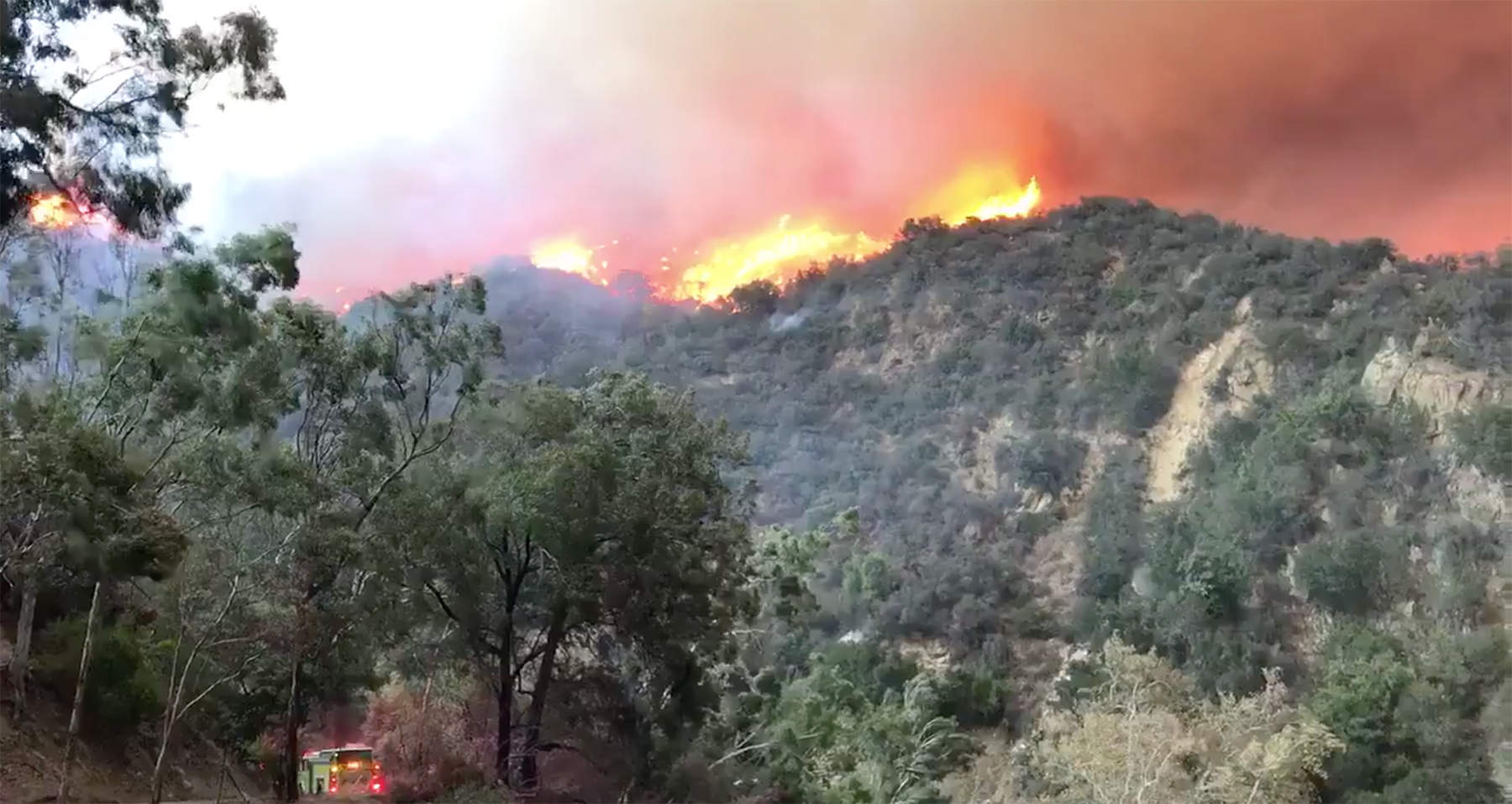
The mandatory evacuation zone was just expanded dramatically at 8:30 a.m. to include everything north of 192 to Highway 154, and in Montecito, from 192 down to 101, between Summit Road and Toro Canyon.
“There is a good line of flames above Mountain Drive View,” explained Santa Barbara County Fire spokesperson Mike Eliason. “They are blowing down canyon.” As of 8 a.m. none of the 34 helicopters assigned to the fire were able to fly, he explained.
Olivas said that the visibility is so bad that even firefighters on the ground are experiencing serious difficulties seeing it. Several large and very large air tankers have been secured as well, but he said the chances of them being deployed is negligible due to wind and visibility concerns. The smoke is so bad, in fact, that actions scheduled today for the northern edge of the fire have been postponed.
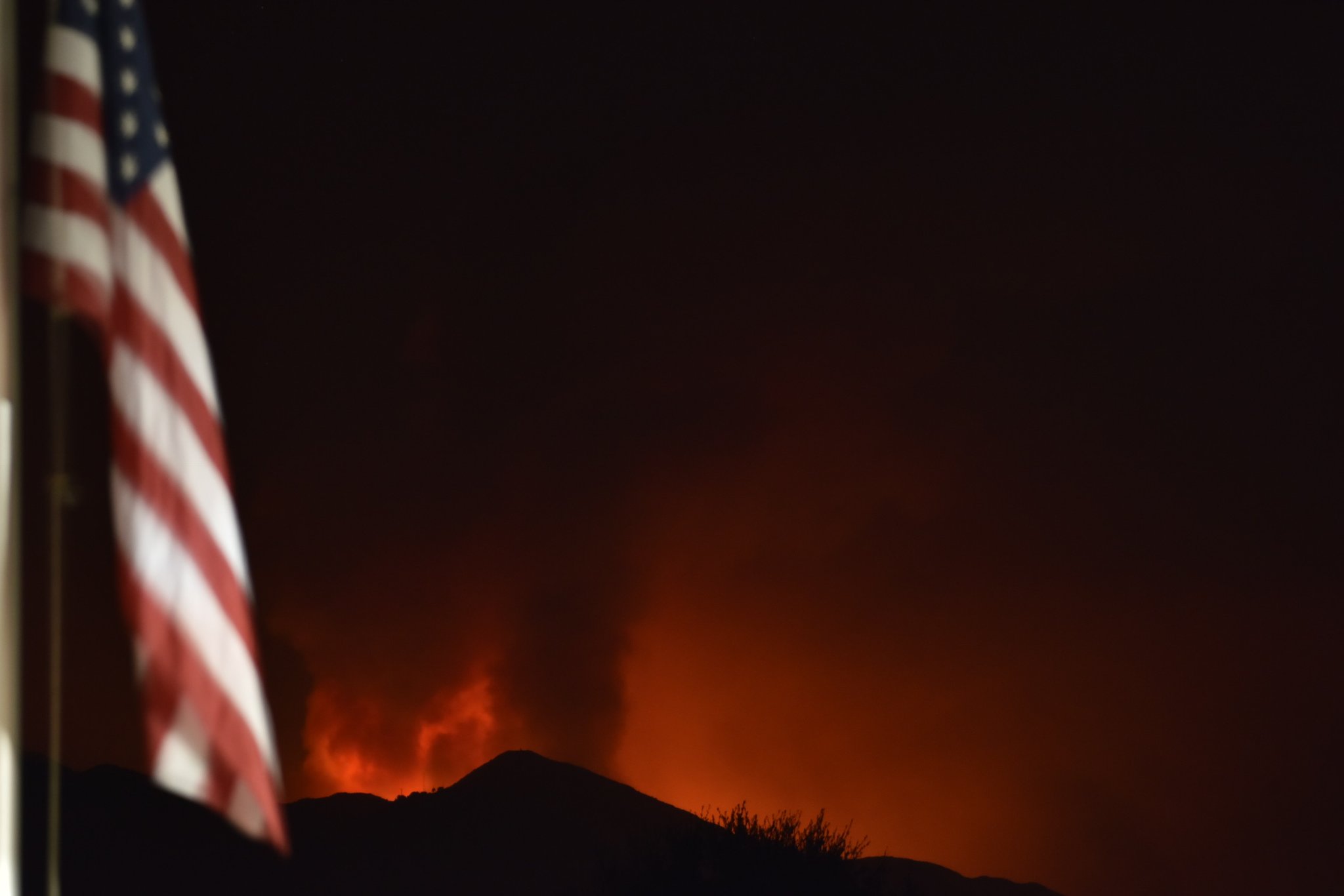
Firefighters had hoped to catch the fire in San Ysidro Canyon, but it “was not doing what they were hoping,” said Eliason, who added that power was out in the lower Milpas area.
Hand crews wearing headlamps had constructed fire line overnight, Olivas said, but with winds kicking up to 36 mph, the fire has jumped the lines. Despite the winds out of the northeast, new plumes of smoke to the north show the fire is backing up against the wind, as fire behavior analyst Brendan Ripley had described at Friday’s night’s town hall, radiating heat and consuming the dry brush upwind.
A helicopter could be seen headed right into the wind, likely commanders on a reconnaissance flight, said Olivas, which they conduct throughout the day and night. When wind conditions become too high, it is too dangerous for heavily loaded water- and retardant-dropping helicopters to fly.
Evacuation orders remain the same, with 4,200 people out of their homes in Santa Barbara County, and 21,000 under voluntary orders, said Kelly Hoover, Sheriff’s Office spokesperson.
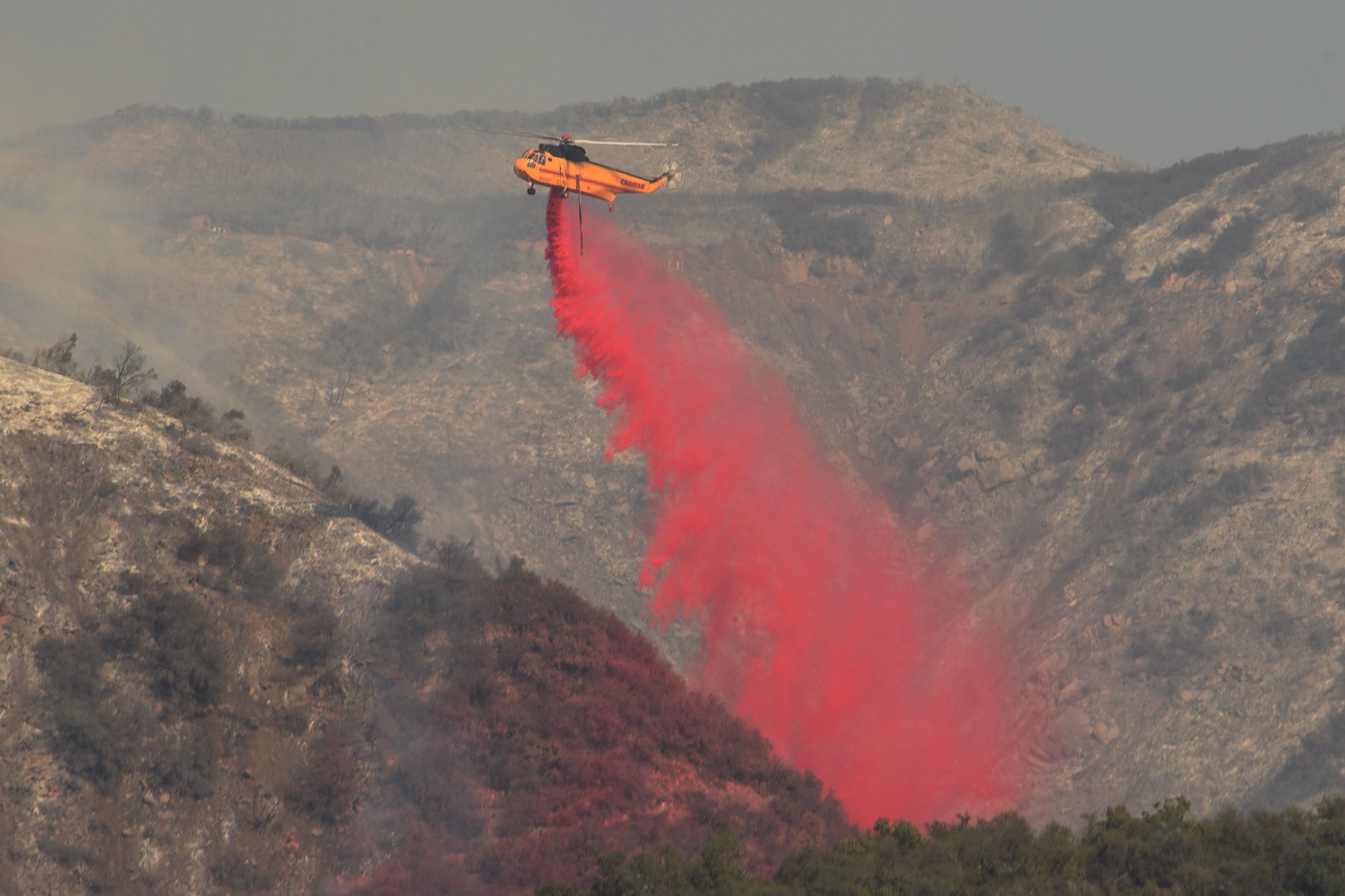
“We”re in an active fight right now,” fire spokesman Steve Concialdi told KEYT Saturday morning. Concialdi said that there were hundreds of fire engines ready to defend homes and that phos-check has been dropped on homes in preparation, and emphasized that those in the evacuation zones must leave. Using a garden hose is like “spitting in the wind,” he said. “We knew these winds were going to be coming but we could only do so much.”
With the Thomas Fire having now moved west into the Cold Springs drainage—over from the San Ysidro Canyon the night, fire officials are asking all Montecito residents living upslope from Highway 192 — otherwise known as Foothill Road — to leave immediately. The new mandatory evacuation order includes the area below the 192/Foothill Road (to the south) from Summit Road and the Montecito Country Club to the east to Toro Canyon Road.
The fire reaches heights of 120 to 150 feet about 4:30 in the morning, with columns rising straight up. By 8 a.m.t had moved into the Cold Springs drainage. If any structures were lost overnight is not immediately known, but public information officials say they don’t know of any. With winds blowing at 20-30 miles an hour, reaching 65 mph at Montecito Peak within the hour, the Red Flag warning remains very much in alert. Thirty four helicopters have been secured and are fighting the flames, which are active on the north wide of the fire in the Sespe area. Six are equipped to drop a mix of retardant and water; the rest are dropping water.


