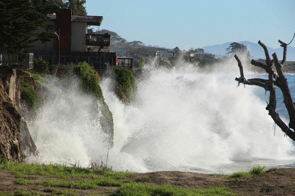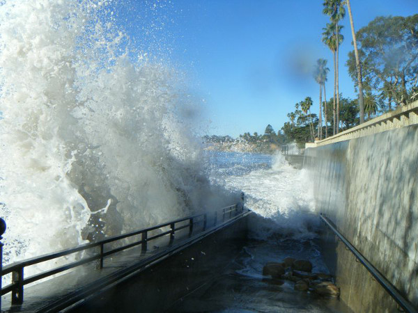
This week, volunteers with Channelkeeper documented the highest tide of the year so far by taking photographs along Santa Barbara County’s shoreline. King tides, as they’re known, are a natural phenomenon, and the nonprofit is using this season’s as an opportunity to see what the sea level rise from climate change might someday look like, said Channelkeeper’s Jenna Driscoll. According to the National Academy of Sciences, the waterline could rise by one foot by 2050 and by five feet by the end of the century.

The volunteer team has been covering a lot of beaches throughout Santa Barbara County and down to Ventura County this winter, looking to document infrastructure, habitats, and houses on cliffs, among other places. The pictures were most impressive in Isla Vista because the swell was a bit higher than usual, and the staircases were completely hit by waves. Waves also reached some of the houses that sit atop I.V.’s cliffs. At Leadbetter Beach, the water came all the way up to the rock wall, Driscoll said.
Channelkeeper’s efforts are part of the King Tide Project, which is made up of many groups and agencies and spans up and down the California coast. Driscoll is looking for volunteers to take part in the picture snapping for February 17-19, when the tides will be high again. The pictures are part of a statewide database that anyone can access to observe changes in the shoreline. To get involved, contact Jenna Driscoll at jennad@sbck.org.


