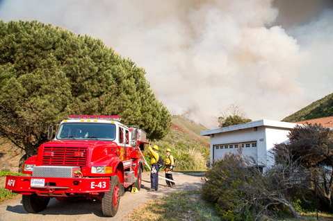
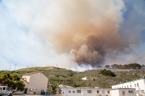
During a period of extremely high heat, with temperatures in the low 90s, the season’s first major wildfire broke out on the hillside immediately north of the diatomaceous earth plant operated by World Minerals on Miguelito Canyon Road at about 1:30 p.m. From that point, the fire began to spread rapidly into grasses and light coastal brush, pushed in a northeasterly direction by light winds toward the east side of Lompoc and interior ranchlands.
Within an hour, engine crews from throughout Santa Barbara County converged on the fire line, along with several large air tankers, including the DC-10 tanker currently stationed at the Santa Maria Airport, numerous helicopters, and a number of dozers. Resources from Cal-Fire, Los Angeles County, Vandenberg, Arroyo Grande, Ventura, and other areas were also on scene within a few hours.
Especially concerned about the portions of Lompoc near the Lompoc Evergreen Cemetery and Beattie Park, an evacuation order was put in place, and homes east and south of Miguelito Canyon and Olive Street were closed to public access. Members of the Santa Barbara County Search and Rescue Team were also on scene going from house to house advising homeowners of the situation and urging them to evacuate. By 4 p.m., due to the number of fire engines coming on scene and increased smoke, Highway 1 was also closed to through traffic.
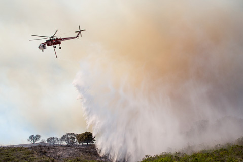
Despite the huge, towering columns of smoke generated by the fire, and the sense of threat that they seemed to pose, the lack of winds, which ranged from a few mph to gentle gusts up to 10 mph, kept the fire from spreading rapidly and made it possible for firefighters to deploy resources and begin building a containment line around the fire. On the diatomaceous earth side, hand crews aided by helicopter drops were able to build containment lines around the south edge of the fire, and what looked like 4-6 dozers could be spotted above the Beattie Park area constructing 10-foot-wide breaks on the steep hillsides above the homes most directly in the line of the flames.
Fortunately for firefighters, much of the fire’s progression toward Lompoc and northeasterly into ranchlands was at a slow-enough pace that the dozers were able to create containment lines along a large portion of the eastern edge of the fire — in many cases three dozer blades wide — creating both space for the engine crews to begin to attack that part of the fire directly and to construct single-dozer blade-width containment lines directly above the Beattie Park area.
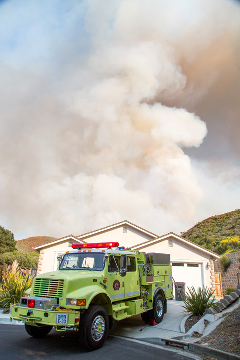
Of most concern to the fire crews were homes at the upper end of South C Street that were directly below a narrow brush-filled canyon. While dozens of engine crews were heading up onto the hills on the eastern edge of the fire to build containment lines there and to mop up hot spots, dozens of others were being deployed at homes in the evacuation area. Fortunately, by 6 p.m., cooler temperatures and a shift in the wind that began to push the fire away from the homes began to provide firefighters with a sense that both conditions and their efforts had shifted things in their favor.
Despite the worry that the fire might push down into the Beattie Park area homes, the most serious threat to the fire expanding into new territory came when one edge of the fire began to work its way northwest from the diatomaceous plant toward the east side of Miguelito Canyon Road. Along one several-hundred yard of the road about a mile from downtown Lompoc, flames in the 20-foot range began to ignite steeper parts of the hillside, and a row of eucalyptus trees bordering the road caught on fire, closing the road temporarily. Fortunately, the lack of wind kept the fire from spotting across the road, with the exception of one place where leaves high in one of the eucalyptus caught on fire. A firefighter using a hose line from the top of one of the engines put that out, and within a few minutes the fire had died down and the threat eliminated.
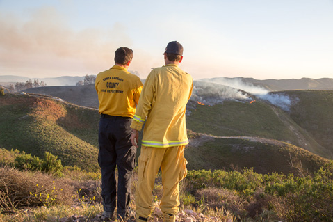
By 7 p.m., firefighters were aided by cooler temperatures and a shift in the wind to the southeast, away from Lompoc. From the hilltop above the city, I stood with several spotters from Santa Barbara County Fire and Cal-Fire who were monitoring the dozer and hand-crew work below them. What had been towering columns of smoke a few hours ago had dwindled to small wisps of smoke, a handful of flare-ups in the middle of a small triangle of brush that was almost completely encircled by the dozer line and the sense that the fire was now moving into a mop-up stage.
Just a week ago at a briefing held at the Museum of Natural History sponsored by our local firefighting agencies, the theme was one of partnership, of those whose job it is to put out the fires, working together with the community and local homeowners to ensure that when the next fire occurs, firefighters can do their job safely and destruction to the community can be minimized. The Miguelito Fire showed that the agencies tasked with responding to a wildfire have done their part.
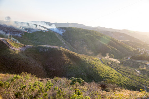
The question remains as to how many of those who live in the fire-prone areas of the county have done theirs. Watching the flames down canyon from the top of C Street, it was clear that some homes in the upper part of that narrow canyon would have been toast if the winds had been strong and directed toward them.
Noting that drought conditions have made the chaparral environment extremely vulnerable to a major wildfire, the word is from every agency that the next fire could come anytime or in any part of the county.
Currently, the fire size is estimated to be 500 acres and is 50 percent contained. The cause of the fire is still under investigation. Conditions are expected to be dry and warm today with 15 mph NW winds in the later afternoon. It is possible the fire could be contained today.


