Name of hike: Strenuous canyon hike and scramble to Matilija Falls in the Matilija Wilderness (Los Padres National Forest South).
Mileage: 9.6 miles in Matilija Canyon. Past “Flat Rock” the wide canyon narrows dramatically until you reach the Falls (you may shorten this for kids by stopping at awesome pools on the creek).
Suggested time: 4-7 hiking hours (50 driving miles from Santa Barbara) bring water, safety gear, fit condition, and companions.
Map: Bryan Conant, Matilija & Dick Smith Wilderness Map Guide (2008)
When Los Padres Forest Watch recently published information about the “Gradual Loss of Hiking Trails” (http://www.lpfw.org/) I naturally downloaded the list right away, and noted a divine destination that has always been on my personal bucket list: ”Middle Fork Matilija Trail.” This is a main trail in the nearby Matilija Wilderness, a federal wilderness area created only in 1992. Although the Matilija is fairly small at 29,600 acres, it abuts the marvelous Dick Smith Wilderness, which also shares a border with the 240,000 acre San Rafael Wilderness.

In the Matilija Wilderness you hike mainly into the eponymous canyon, including the lovely North Fork Matilija camping area enjoying alders, sycamores, and maples. We will pass by the “Upper North Fork Matilija Trail” sign and turn-off, noting it’s trail 23W07, and some outstanding backpack camps up there include Upper Matilija and Maple. The North Fork Matilija is a terrific Eden, especially for parents and children, and I will discuss it in another column. For this “Middle Matilija” trek I inveigled my old grad school buddy, Franko, to join this grueling 9.6 mile day hike to Matilija Falls since he’s very experienced and has been there before. “It’s a tough hike and a long day,” said guru Franko. Our chum Marc jumped in, so there were three of us in my truck charging down the 101 at 7:30 a.m.. We had boots, small fanny packs, lots of water (won’t drink creek water), hiking sticks, big hats, and all wore shorts for the promised hot day in the Ojai.
Having someone along who has already visited these wonderful waterfalls seems necessary, since there are a number of confusing turns and trails along the way; I’m not at all sure I could have located Matilija Falls on the first try. At one juncture, you make a counter-intuitive turn north toward Divide Peak, and earlier you contend with misleading signage, and a formidable “PRIVATE PROPERTY” sign.
Los Padres Forest Watch is a worthy non-profit that has performed a valuable service by putting out this information about the loss or threatened loss of hiking trails in our backcountry. They claim that the trail we’re taking today, June 6, is a success story, and that with public attention this crucial access to Matilija Falls through two private ranches has been maintained. It’s important to remember that our Matilija Wilderness is barely 20 years old, and rights of way and access points may need to be debated and refined. We should be grateful to the many supporters of forest access, including Forest Watch, for sustaining this public easement. This is well and good, however, even this trail into the Middle Matilija area, whose access did not get lost, has a confusing trail junction, which I explain below.
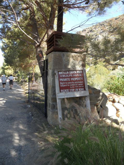
After the 50-mile drive from Santa Barbara’s Westside we park at the locked gate in front of the attractive Matilija Canyon Ranch, a wildlife refuge and private property. (See Driving Directions to Matilija Wilderness from Santa Barbara at bottom of column.) Matilija Canyon Road ends here for the driving public.
Walking around this first gate, we walk up to a second, open, black-iron gate into the green Ranch grounds and quietly walk right through on a dirt road weaving between the orchards, the horses, and the huge cage with exotic birds and loud cries. No one is around the main ranch house, and we stay on the road making little noise. The exotic birds’ weird calls echoed for some time as we hiked along the wide-open dirt version of the USFS Matilja Canyon Road, surrounded by hard chaparral and high mountains
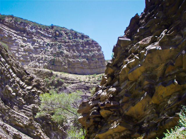
Old Man Mountain looms tall to our northwest at 5500 feet, and I’m looking forward to getting into the rocky gorge ahead.
We trudge along on the level road, deliberately bypassing the aforementioned “Upper North Fork Matilija Trail” sign, and after 1.1 miles encounter the crucial T junction: we can only go left or right. In contrast to city life and human society, there is no ambiguity here, you’re either a Socialist or a Capitalist. Here we spy another USFS sign.
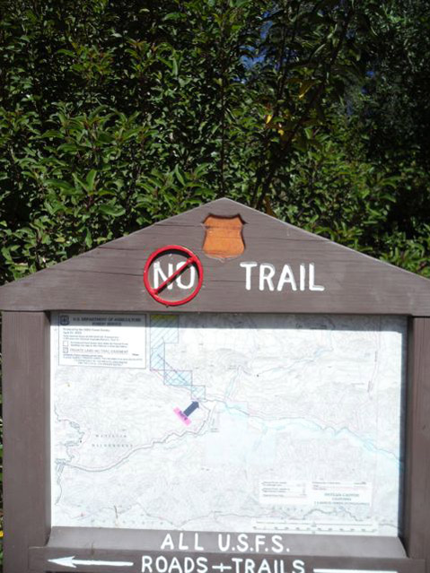
The left direction is the one “they” want you to take: carefully note the long, white, horizontal arrow pointing LEFT down at the bottom of the photo on the right. But we won’t go left in the direction the white arrow indicates. This would be the Murietta Trail (24W07),which is a steep and tough 4.0 mile ascent to the Murietta Divide, not the path we are seeking. (I have mountain biked to the very cool Murietta Divide from the other side, off of E. Camino Cielo Rd, beginning at Juncal Camp, but that’s another story.)
But the only arrow on this official USFS, above which you read in large white capital letters “ALL U.S.F.S. ROADS +TRAILS”, points emphatically left toward the Murietta Divide as noted. Perplexed, we of course look to the right, and we see a large “PRIVATE PROPERTY” sign at the Blue Heron Ranch development. We look again at the Forest Service sign — note that the USFS logo has been torn out of the depression in the top of the sign — and we see at the top in large white letters above the map: “NO TRAIL.” But then a round, red plastic-like circle has been superimposed upon the NO with a diagonal: the universal sign for “not.” A most confusing double negative, which is as confusing in the wild as it is in writing. It’s not clear at all, but we know we need to go RIGHT and pass through this second private ranch because Matilija Creek is over there, eastward is Eden, we can hear it rumbling behind the ranch-house building.
“Look,”someone says, “I was raised to question authority, the PRIVATE PROPERTY sign is big, but it’s just a notification; there aren’t any NO TRESPASSING signs around.” This was true, and we scrutinized the area again. Another said, “Well, I was raised reading Mad Magazine so ‘what me worry?’”
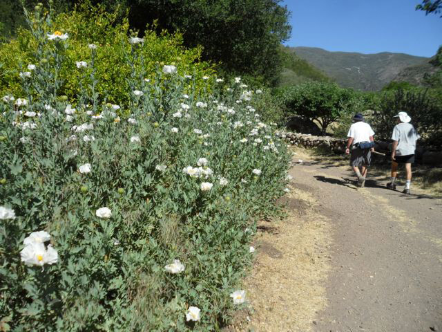
We thus respectfully walked into the Blue Heron Ranch, passing through an open door-way space built next to a second and sturdier locked gate, and continued on another 1.1 miles as the road petered out and we were closer to Matilija Creek. Our trio hiked past the orchard trees along the bucolic road marked by low stone walls on both sides, and a beautiful stand of glorious white Matilija poppies.
It isn’t clear where the ranch property stops, but the low stone wall gives out,and we keep hiking on canyon’s left side, along the wide bench sloping east down to the flowing creek. At one point,the footpath veers north-west and I think we’re in the opening to Old Man Mountain Canyon, and there is an unmarked trail choice: we keep right and soon come back down closer to Middle Matilija Creek, where we will eventually wind up.
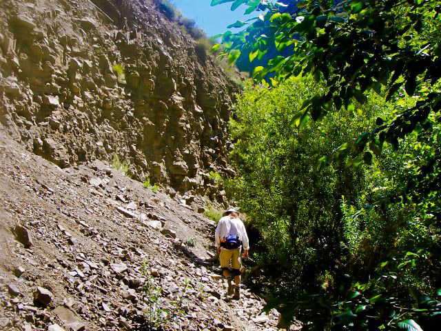
We’re now over two hours and two miles “in” and feeling fortunate we haven’t yet been forced down into the bowels of the running Matilija, a V-shaped wash and chaotic jumble of crazy boulders and rushing water. We’re in the “Sespe formation” with wild and erratic vaulting of the strata, purplish rocks, a geologists’ delight. As we continue on, the trail does drop into the creek bed and our rate slows considerably. Sometimes the trail literally disappears amid recent rockfalls and masses of scree.
We discover several awesome pools as we get into the creek bed, and there are at least six or seven “free” campsites with fire pits and fabulous swimming holes nearby.
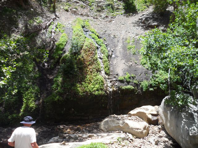
The canyon narrows dramatically after Old Man Canyon and becomes a spectacular gorge with high rocks above on all sides, and even deeper pools. Luckily, Middle Matilija Creek is fairly low since the recent winter has been quite sparse, under 11 inches total.
We faced some slippery spots, and one guy fell and bashed his right shin up fairly badly. After about three hours we reached fabled Matilija Falls.
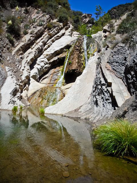
Because our rainfall was so low this year, the spill over isn’t so dramatic, but imagine how this was a year ago after our 26” winter rains. The drainage above Matilija Falls includes Wild Mare Canyon as well as West Fall Canyon. When we look around, we see West Falls, too.
Absolutely tired, we eat a bit and are about to head back when Franko notices this amazing spring simply gushing out of a dry hillside opposite Matilija Falls
This miracle could be the equivalent New World spring to the rock in the Wilderness of Sin that Moses struck during the Hebrews’ flight from their Egypt Captivity. (Yah-weh commanded Moses: “you shall strike the rock, and water will come out of it, and the people will drink” Exodus 17:6.)
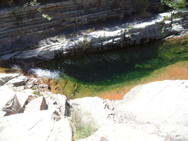
Encouraged and feeling blessed by the glory of this spurting goodness, with strong hearts,accepting our limits and sore knees and hands… we trudged back across the same 4.8 miles we had come up refreshed by the pure mountain spring water we had guzzled. It was mid-afternoon and we were in hours six and seven of the hike; it was quite warm despite a pleasant breeze so we needed this miracle re-supply of sacred liquid. Later, at the last big pool on the way out we stopped and swam a bit in this natural “tank” which was eight feet deep, or more.
American historian Donald Worster asks the question, “Can we have strong communities where people have lost any awareness of limits?” He worries that over here in western America “we continue to approach nature as isolated, almost antisocial,individuals, either seeking total release from all entanglements with others or insisting on an unlimited right to acquire as much private wealth as we can.” Thus we can have ardent backpackers who in their day-jobs further the financial industry’s dominance and disregard for“limits” and gross indebtedness.
At Matilija Falls I quickly scrambled up the ledge to the right (looking hard you may be able to detect the upper of the two provided ropes about two-thirds of the way. Then my hands started killing me from my death-grip on the tiny, blue, nylon rope, ANDI didn’t like the transition I could see I’d have to do to cross through to switch to the upper rope. Hearing my protective daimon’s judgment, “check yourself”, I stopped abruptly and very laboriously came back down. I had met my limit for this day on this bit of exposure out on the slanting shale.
N.Y. Times conservative columnist David Brooks attributes our shocking tolerance of indebtedness today to the loss of our grandparents’“abhorrence of debt” coming out of the Depression. Yet the more honest acknowledgement of our financial limits will certainly impact the strength of our communities as we hack into the social safety net, the very issue Worster raises. Does Nature have limits? Does the government? Do I face my limits and make adjustments? These treks into the backcountry, and occasional backpacks,force me to measure and adapt to my actual limits. I have no screens to hide behind, no iPod to soothe my jangled linear brain, no iPad on which to play endless electronic games.
However, a focus on the government’s limits could include reductions that weaken federal protection for the national forest, and possible loss of more open trails in our local wilderness jewel, Los Padres National Forest South, including the Matilija Wilderness.
My friends and I did not see another human on the intermittent trail to Matilija Falls, except at the very end nearing the truck. Each booted stride we negotiated along the convoluted creek,the poison oak we brushed by and the ticks we flicked off, and all the strict limitations brought on by age, achy joints, minor falls, and gnarly terrain enhanced one-pointed focus. Immersing oneself in this focus means you don’t want to be a burden [indebted] to the others; you accept your obvious physical limitations and perforce explore any new ones. In Hinduism, this can be called tat tvam asi — Sanskrit for “that thou art” and “thou art that”.
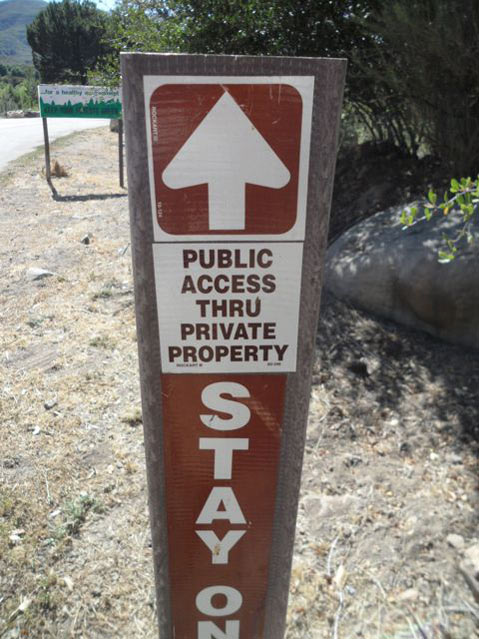
The Forest Service and private individuals have kept “the way” open to Matilija Falls via Middle Matilija Creek, but you have to be determined in order to figure out the situation at the weird trail sign. The only arrow points LEFT, but the NO TRAIL sign winks at you: if the Man wants you to go left, go right. You do cross through the second ranch (Blue Heron Ranch), and it’s important to have some gratitude and awareness of the situation. Part of the time you are walking on private property, but you have guaranteed public access, an historic easement: remain respectful, and display your gratefulness by staying on the road.
Driving Directions to Matilija Wilderness from Santa Barbara — drive south on the 101 Freeway to the Highway 33 turnoff taking you past Ojai to your final left turn at Matilija Canyon Road. When I drove it from the Westside my truck’s trip odometer read: SB to Hwy 33 = 28 miles; on the 33 to Matilija Canyon Rd =18 more miles; on Matilija Canyon to the locked gate 4.5 more miles. About 51 mile drive one-way.


