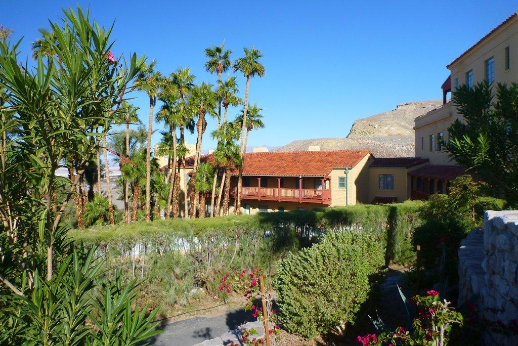
Good Day Sunshine: If ever there were an ideal place to harness solar energy, it’s sun-drenched Death Valley National Park. Staying at Furnace Creek Inn recently, we found that the resort and its sister, Furnace Creek Ranch, get 30 percent of their electrical juice from solar power panels.
Over 30 years, the system will eliminate more than 284,000 tons of pollutants that contribute to global warming, acid rain, and smog, according to Xanterra, which operates the resorts.
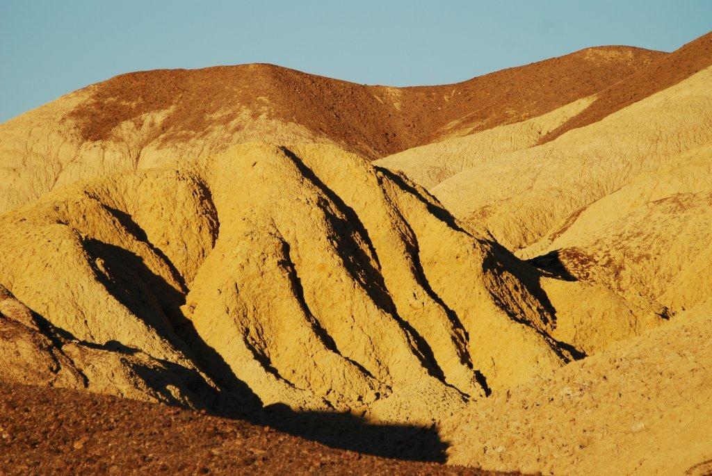
To some, Death Valley is just a dusty, isolated rock pile that heats up to 115 degrees in summer. (Foreigners love it then, for reasons I’ve never been able to discover.) In fact, Death Valley has just been recognized as the hottest spot on Earth.
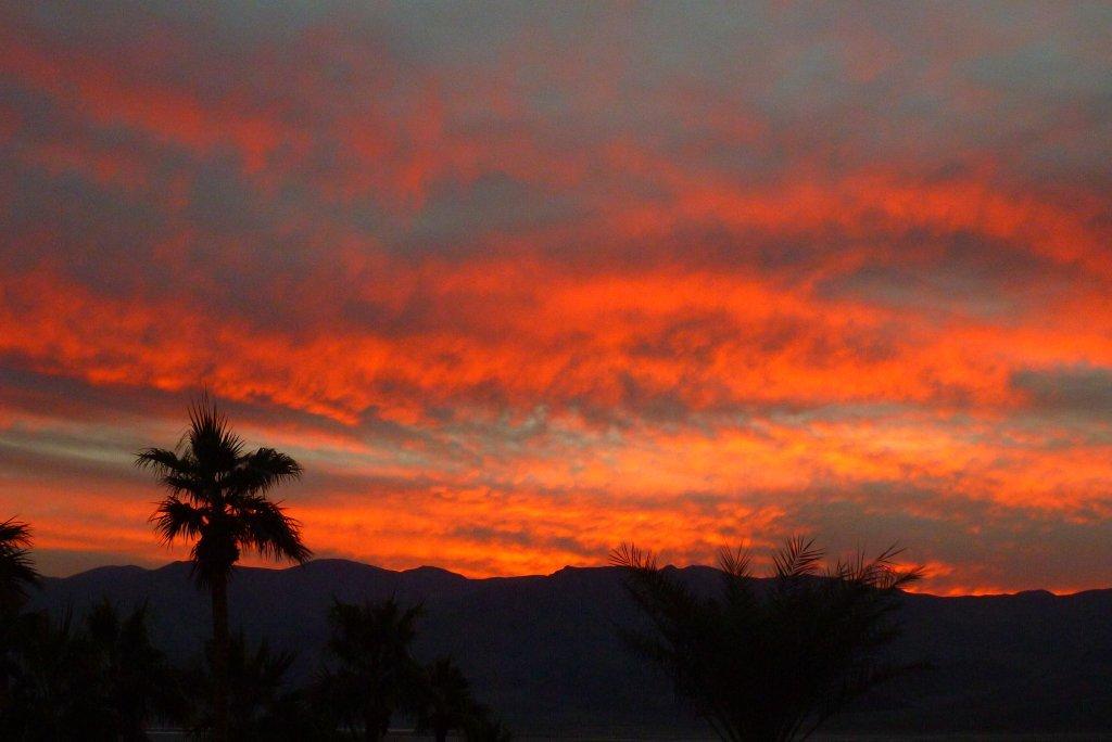
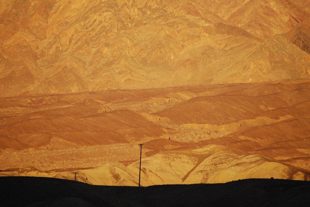
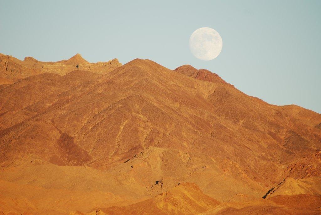
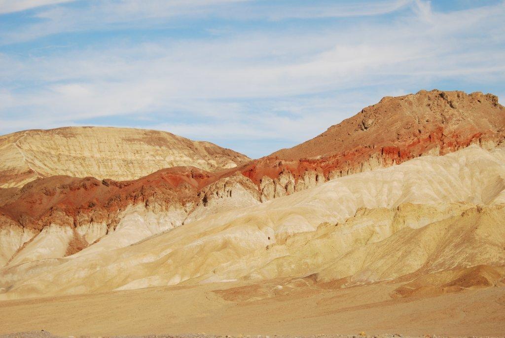
It took decades for the park to win that dubious honor, but it’s now been officially proclaimed that on July 10, 1913, the mercury hit 134 degrees at Furnace Creek. But in winter and spring, when the valley cools off, it’s a mecca for those of us who find great beauty in the panorama of rocky hills painted subtle colors, and the vastness where, once you leave Furnace Creek and Stovepipe Wells, there’s little sign of man.
And it’s quiet, something rare in our noisy world. Sue and I sat on the deck at 1927-era Furnace Creek Inn and gazed down on 3.3 million acres of designated wilderness, or as much of it as we could see, and heard — nothing.
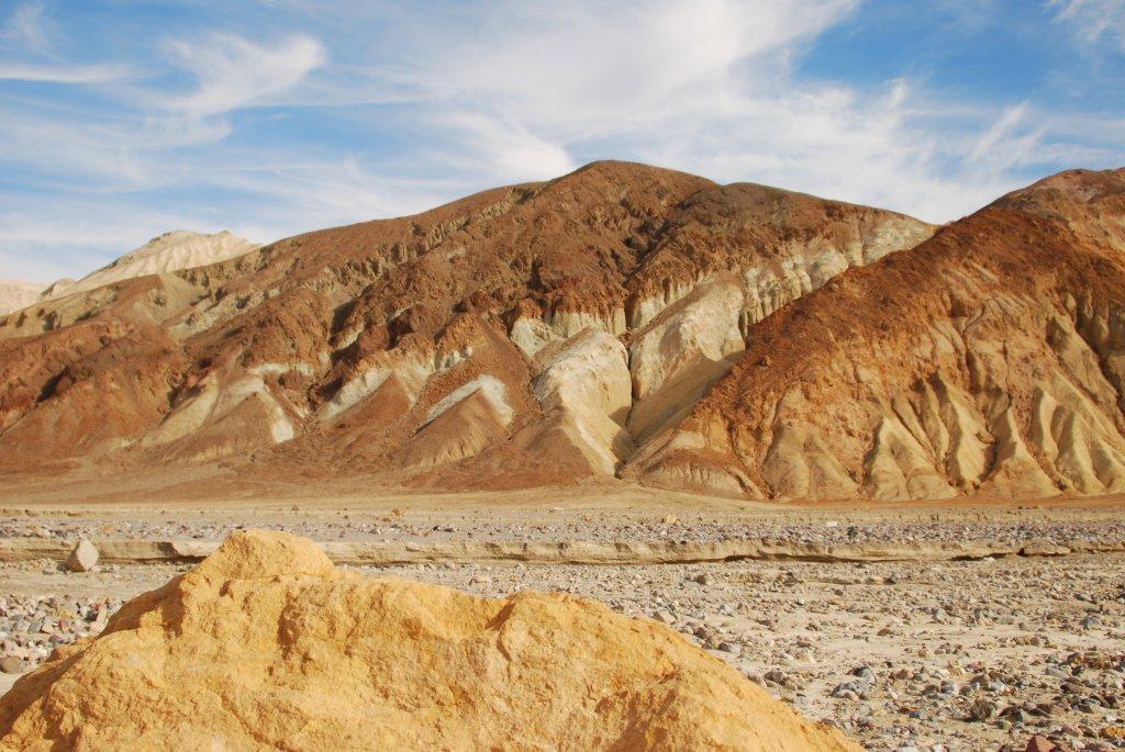
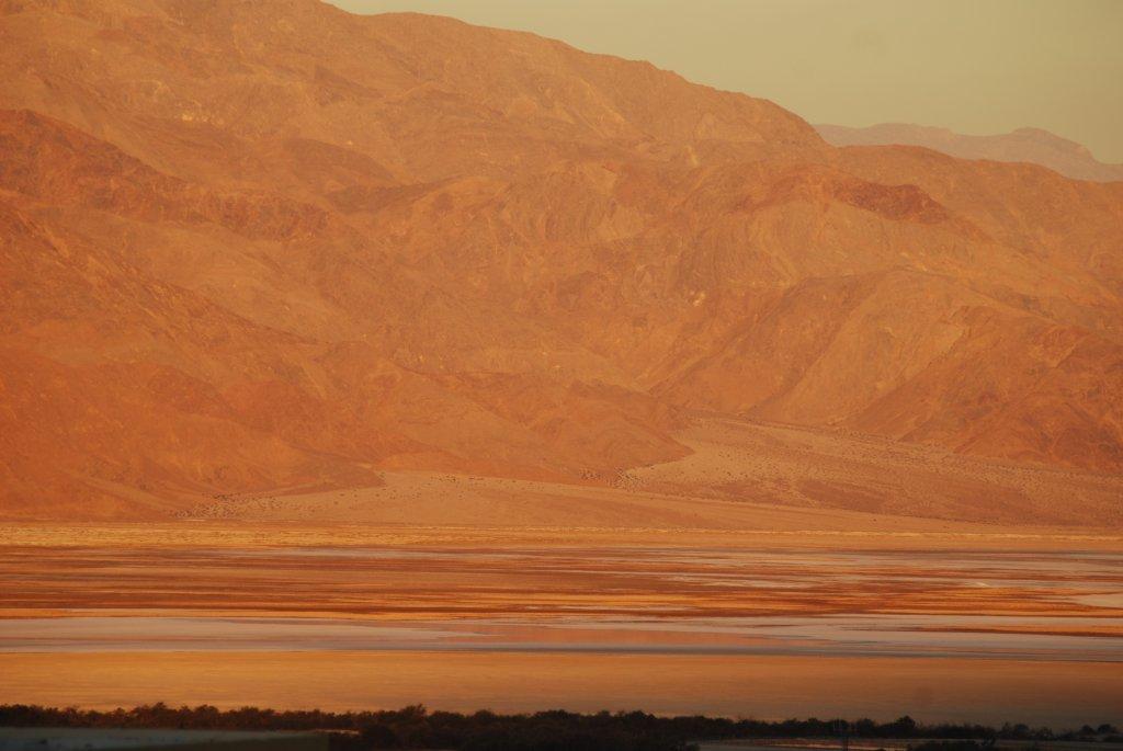
But there’s plenty to see. One of the major attractions is murky Badwater Basin, the lowest point in North America, 282 feet below sea level. It’s a temporary lake, where water collects after rare heavy rains. You can walk far out on the salt flats, just don’t drink the water. Mount Whitney, at 14,505 feet the highest point in the contiguous United States, is just 84.6 miles from the lowest point, Badwater.
One of the busiest places is the 18-hole Furnace Creek golf course, where you can tee off at 214 feet below sea level. It’s our favorite spot for a burger. (Not to be confused with Devil’s Golf Course, a rough expanse of eroded rock salt where, as the saying goes, “only the devil could play golf.”)
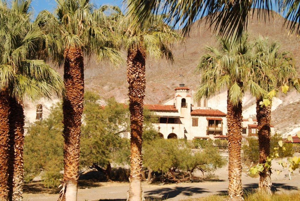
I’d never been to Scotty’s Castle before, having mistakenly crossed it off as some kind of tourist trap. This time Sue and I made the 50-mile drive up to the north end of the valley and found a spring-fed oasis where millionaires Albert and Bessie Johnson, lured west by con man Walter (“Death Valley Scotty”) Scott, decide to build a magnificent Spanish-Moorish castle in the arid desert.
Scotty, one of the great fast-talking crooks of the West, made a practice of bilking the rich with tall tales of his (nonexistent) gold mine. The easy-going Johnson caught on quickly to the ruse but enjoyed Scotty’s stories. They became fast friends. Scotty entertained guests and gave the impression that it was his home. Johnson poured millions into the place during the 1920s and 1930s, harnessing the spring to provide power using a Pelton water wheel. Upstairs, the mansion rang with music from a grand piano and an organ, according to our guide, a tall park ranger by the name of Eric Knackmuhs, who was dressed in a period pinstripe suit. Tours are $15.
The only problem was, the Johnsons mistakenly built their castle not on their own land but on public property, due to a surveying error. That got settled and now it’s park property and well worth seeing. Ubehebe Crater, 600 feet deep, result of an ancient volcanic explosion, is nearby.
There are a variety of cabins and motel-like units at Furnace Creek Ranch, along with a restaurant, bar, and general store. Also a service station where we found gas at around $5.30 a gallon. No matter, make sure you fill up. Running out of gas can be dangerous. Gas is also available, and cheaper, we found, at Stovepipe Wells, near the west entrance to the park, along with accommodations and food.
You can’t miss the expanse of hundred-foot-high sand dunes near Stovepipe Wells, with a place to park so you can wander over. It’s a photographer’s paradise. Best shots are in the morning or late afternoon. With luck, you may spot a coyote. To explore remote parts of the park not suitable for the family jalopy, Jeeps are available for rent at Furnace Creek.


Print friendly
E-mail story
Tip Us Off
Comments
Share Article
Myspace


Previous Month


Comments
My favorite place in Death Valley is Titus Canyon. If you have a high-clearance vehicle (4WD isn't needed) the 27-mile drive is spectacular.
The route is mostly one-way and takes you over and down a mountain pass where you can explore old mines (the old mining town of Leadfield is there) and see petroglyphs at Klare Spring. The high vertical canyon walls at the far end are amazing and offer shade from the sun on hot days.
Speaking of Europeans, I once ran into a French couple from Paris who had walked into the canyon on a 100F+ summer day - a hardy pair!
If you visit Titus Canyon, you might as well visit the nearby ghost town of Rhyolite. There's a famous house built from glass bottles there. Also an old cemetary just outside of town.
Keane Wonder mine is also on that side of Death Valley. I recommend it if you're looking for a vigorous hike. Great views of the valley floor at sunset.
EastBeach (anonymous profile)
December 26, 2012 at 1:52 p.m. (Suggest removal)
Tule Fog in winter/spring and long power transmission distances to any metropolis are probable reasons why solar has not gone large scale there. I'm told that Tule Fog is the reason why there aren't a lot of large scale solar plants in California's Central Valley. The Carrizo Plain/California Valley area is at a higher elevation and does not get Tule Fog, making it an Ideal location.
GluteousMaximus (anonymous profile)
December 26, 2012 at 3:35 p.m. (Suggest removal)
thanks EB for note on Titus Canyon, I'm going there! My son and I have enjoyed the so-called 'racetrack' area in years past, as well as the route in through the lonely Panamint Mtns. with the remnants of the charcoal kilns and wild burros. How hard are the petroglyphs to locate in Titus C?
DrDan (anonymous profile)
December 26, 2012 at 4:21 p.m. (Suggest removal)
@DrDan - spot on! The drive through Panamint Valley is eerily lonley and magnificent at the same time. The first time through, I had to pull over and watch the sunset over the Argus Mountains to the west.
If you zero out the trip odometer when you pull onto the gravel road off Hwy 374 / Daylight Pass Rd, you can use these mileage markers from Michel Digonnet's guide, "Hiking Death Valley":
Miles / Feet elevation
Hwy 374 0.0 / 3,505
Red Pass 12.6 / 5,290
Leadfield 15.8 / 4,040
Titus Canyon 16.5 / 3,750
Klare Spring 18.4 / 3,120
Facing side canyons 19.6 / 2,700
Narrows 20.3 / 2,420
Mouth 24.3 / 940
Scotty's Castle Rd 26.9 / 169
GPS coordinates for Klare Spring are (off my Garmin topo map, WGS84 datum):
N 36 50' 28.8", W 117 05' 28.2"
Digonnet says the road is sometimes gated in the summer but you can get keys at the visitor center (maybe a precaution for flash floods?).
The spring is very easy to find. As you approach, you may notice the area looks a bit too lush. The petroglyphs are out in the open on a a rock outcrop adjacent to the right/north-side of the dirt road. These are the only Petroglyphs I've ever seen where you drive right up to them! Four years ago, they were in great condition.
Hike around the slope on the left/south side and you'll find a large variety of small cacti and succulents.
If short on time, I recommend driving to the far (west) end of the the canyon (there is a parking lot at the mouth) and hiking into the narrows.
Tweed and Davis' "Death Valley and the Northern Mojave - A Visitor's Guide" is another good reference, and the California Road Atlas from Benchmark Maps covers the area well.
Have a great time when you visit, hopefully the wildflowers will bloom well this spring.
EastBeach (anonymous profile)
December 27, 2012 at 1:17 p.m. (Suggest removal)
It was a delight. A few years ago, we went on vacation and spent two nights in Vegas and one in Death Valley. Afterwards, we were cursing ourselves for not spending another night there. There is much worth seeing. The absolute quiet outside is difficult to describe. You have visibility for 50 miles or so but hear virtually nothing. It's so quiest, it's almost like being indoors. We would like to make another trip next winter!
Botany (anonymous profile)
December 27, 2012 at 2:23 p.m. (Suggest removal)
Yes, when it's not windy, the quiet in Death Valley is almost deafening :) The only other place I've been to that's so quiet is @ bottom of the Grand Canyon.
If you can time a visit to Death Valley with the full moon, another neat thing to do, especially when it's warm, is to take a night hike in the sand dunes across from Stovepipe Wells (where Barney noted the gas station). The one time we did that, we were surprised to see lots of cars parked along the side of the road.
Be sure not to stray too far without taking along a GPS or compass, day or night, it's easy to get lost in the dunes.
EastBeach (anonymous profile)
December 27, 2012 at 5:02 p.m. (Suggest removal)
thanks EB! & I've noted the GPS coordinates...missed it this full moon but am laying plans...
one can find some inspiring QUIET in the middle of the San Rafael Wilderness up on MP Ridge, of course...
and there's the amazing Bearpaw petroglyph up on Hurricane Deck past Potrero Cyn Camp, but its one of the very few local petroglyphs I've managed to locate
DrDan (anonymous profile)
December 28, 2012 at 6:57 a.m. (Suggest removal)