Wet ‘n Wild
Storm Batters Santa Barbara; More to Come
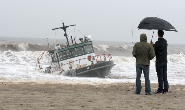
The first day of spring officially sprang on Sunday, but no one, it seems, told Mother Nature. Riding a classical winteresque jet stream, one of the fiercest storms of the year tore through the South Coast last weekend, dumping historic amounts of rain, prompting evacuations and flash flood warnings, stranding boats, filling reservoirs well past their limits, and wreaking some mid-grade havoc for residents. According to county’s rain gauges, the storm — which lasted from Saturday afternoon straight through until Monday — dumped nearly 12 inches of rain at Lake Cachuma and the Gibraltar Reservoir, 8.5 inches in Santa Ynez, almost 11 inches on San Marcos Pass, and roughly 5.5 inches in downtown Santa Barbara. To date, Santa Barbara proper has seen just shy of 26 inches of rain since the “water year” began last September — a number that is roughly 165 percent of our annual average.
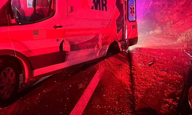
Besides climbing high on the rain charts, this past weekend’s storm was also responsible for the temporary evacuation of several homes in Guadalupe as the nearby Santa Maria River rose to some 20 feet, well in excess of its “flood” level of 15 feet. Additionally, a home on the 1400 block of San Marcos Pass felt the wrath of a landslide on Monday morning (fire officials said there were no injuries), and a group of Boy Scouts from Lompoc — 12 actual Scouts and 6 leaders — had to be airlifted out of the San Rafael Wilderness after rains made the Manzana Creek impassible and they found themselves stranded near Nira Campground.
According to the National Weather Service, rain is once again in the forecast for the latter half of this week with sunshine returning in time for the weekend.