
First Look at the Gap Fire’s Aftermath
With Wet Weather Coming Soon, What Will Happen to the Canyons Above Goleta?

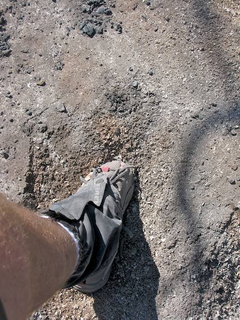
The fire-scorched ground had barely cooled enough to walk on when I headed down off West Camino Cielo for a first-hand look at the impacts from the Gap Fire. Given the acreage being chewed up by fires elsewhere in California, a 9,400-acre fire doesn’t sound like much – except when it’s on steep mountainsides immediately above where you live. Then it becomes a really big deal.
With wet weather just a few months away, the reality is a stark one. Because the Gap Fire spread laterally, there are a handful of canyons – Eagle, Tecolote, Ellwood, McCoy, Bartlett, San Pedro, and San Jose – that can funnel ash, loose dirt, rocks, burned brush, and other materials down from the mountains into the ranchlands and, if the rainfall is ample enough, all the way to town. While many won’t remember the huge piles of deadwood clogging each of the Carpinteria area bridges on Highway 101 and the miles of mud-filled freeway after the 1971 Romero Fire, the potential for such damage this winter is real.
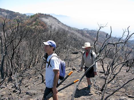
My first entry into the post-fire wilderness above Goleta is with two friends, Otis and Ron, who, like me, are curious how much burned and how far we can really go. Near the crest, much of the brush is still in place, a curious twist given that the fire started not too far from here. The reason is simple: For most of the Gap Fire, gentle sundowner winds kept the fire from reaching the crest, save for the few places where firefighters had to stop it from jumping the road.
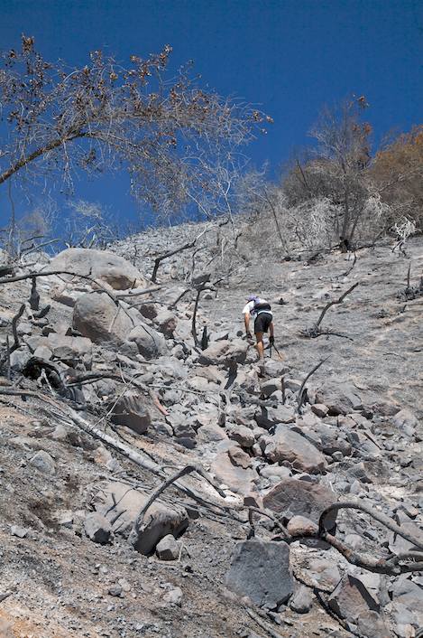
We head downhill along the firefighters’ initial attack line and, within a few hundred yards, the live brush gives way to big patches of black hillside. A few hundred more yards bring us to a swatch of sandstone boulders ranging from 10 to 15 feet in height. With the exception of larger oaks and a few other trees sheltered by the rocks, everything has burned, so navigating through the charred maze is relatively easy. Otis follows Ron down through a series of channels that take us further down the hill and I follow. Almost as quickly as we enter, we exit into what looks like open territory, soon realizing everything that could be consumed by the fire was.
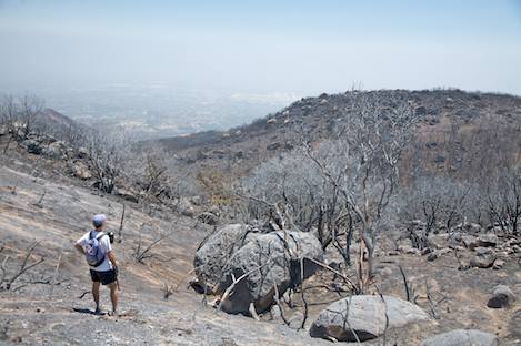
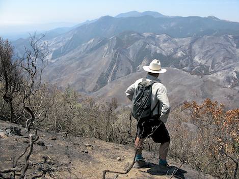
All three of us are stunned, both by the beauty of the rock-strewn hillsides and the extent of the burn. From town, there is just enough haze to hide the extent of the damage, and from the crest, most of it is hidden from view by the chaparral. But here in the middle, everything except for a few deep canyons and wind-sheltered hillsides has burned.
The ash is deep, 6 to 8 inches in places. What’s left of the manzanita, chamise, and ceanothus are fields of blackened skeletons. We work our way west from The Playground to a point where we look directly down into the Ellwood drainage. We’ve gone more than two miles at this point and 90 percent of what we’ve traversed is ash and sticks, thousands of acres with almost nothing to hold the hillsides together when the rains do come. But even before that, we’ll be paying a heavy price when the fall sundowners descend: With tons of burned material covering the mountains, last year’s ash storms will more than likely seem like nothing.
Of biggest concern, however, is that much of the area burned is on U.S. Forest Service land, but almost all of the impacts will be to the ranchers and watersheds down below. And with such steep terrain and a lack of potential spots to slow down the sediment flow, any storm-powered mud slides may prove impossible to stop before it inundates the foothill canyons below.
Working on possible solutions to that is the Burned Area Emergency Response (BAER) team, the group routinely assembled by the Forest Service after wildfires to assess watershed damaged that has been meeting for the past several days. Composed of soil scientists, hydrologists, geologists, and other resource specialists, their goal is to recommend treatments that will help mitigate issues relating to flooding, debris flow, and sedimentation. Normally, the BAER work is cause for optimism. But in the case of the Gap Fire, what can be done on Forest Service lands is uncertain at best.
“The terrain is definitely a limiting factor,” said BAER team leader Liz Schnackenberg, who explained that about half of the burn was on federal Forest Service land and half on private land. “We can only recommend treatments on the forest part of the burn area, and most of this presents a major challenge.” For the private side, Schnackenberg said they are working with other agencies, such as the Natural Resources Conservation Service, “to see what can be done to protect the private lands.”
In the meantime, stay tuned to independent.com to see when the BAER recommendations are made public.
411
To see Ray Ford’s photos of the burned areas, go to Gap Burn Photos. For more outdoor coverage – including trails, beach walks, and bike rides – see Indy Outdoors.


