• CREATE AN ACCOUNT
  • LOG.IN
  • CONTENTS
  • CLASSIFIEDS
  • ARCHIVE
  • INFO | ADVERTISING | CONTACT US

  • Home
  • News
    • Business
    • NewsFlash
  • A&E
    • Movie Times
    • TV Listings
    • A&E Blog
    • Art Galleries
    • Best Bets
  • Opinion
    • Columns
    • Voices
    • Letters
    • In Memoriam
  • Events
    • Today
    • Search
    • Submit
    • Best Bets
  • Living
    • Travel
    • Sports
    • Peeps
  • Food & Drink
    • All Restaurants
    • Delivery
    • All Bars & Clubs
    • Drink Specials
    • Open Now
  • Outdoors
    • Outside Insider
    • Spotlight On
    • Features
  • Classifieds
    • Real Estate
    • Jobs
    • Autos
  • Personals
  • Obits

From File

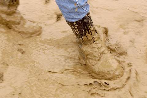
Flash Flood Warning Issued

Humid Weather May Bring Unseasonal Rains, Further Troubles


Sunday, July 13, 2008
By Indy Staff
Article Tools
Print friendly
E-mail story
Contact an Editor
iPod friendly
Comments
Bookmark This
del.icio.us. del.icio.us.
Digg! Digg!
furl furl
google google
newsvine newsvine
reddit reddit
technorati technorati
Facebook Facebook
Yahoo! My Web 2.0 Yahoo!

[National weather service, Los Angeles/ Oxnard, 2:02 pm, July, 13] A Flash Flood watch remains in effect for portions of Los Angeles, Ventura, and Santa Barbara counties, including several recent burn areas.

A strong monsoonal surge has brought significant moisture into southwestern California. Several thunderstorms have already formed over the area, and will continue to form and increase in coverage through the afternoon and evening.

These thunderstorms will likely produce heavy downpours. In addition, upper level winds are very light. As a result these thunderstorms will be slow moving and will have the potential to produce flash flooding.

Thunderstorm activity may last through the night, but the heaviest downpours are expected through this evening.

The greatest potential for flash flooding will be in the Antelope Valley, the mountains of Santa Barbara, Ventura, and Los Angeles counties excluding the Santa Monica range.

Particularly vulnerable will be the burn areas of fires that have occurred in the last two years including the Santa Anita and Big Horn burn areas which occurred earlier this year. Any flash flooding that occurs in the recent burn areas could be accompanied by significant mud and debris flows

Related Links

  • Our Weather page
Story Help (Click-ability)
Double-clicking on any word or phrase in this story will open a reference window with definitions and links to other reference material.

Comments

Discussion Guidelines

Post a comment

Username:
Password: (Forgotten your password?)

Comment:

EVENT CALENDAR

Previous Month | Next Month

Today's Events Best Bets Submit an Event

Local Weather

Currently:
Mist
Temperature:
64.0°
Wind:
5 SE

Surf Report
  • Specials
  • InPrint
  • Top Emails
  • Blue Green Guide 2008
  • Summer Camp Guide 2008
  • Wedding Guide 2008
  • SBIFF 2008 All Access
  • 2008 Election Coverage
  • Best of Reader's Poll 2007
  • Calendar of Fundraisers
  • Local Bands
  • Kid's Mother's Day Issue
  • Made in Santa Barbara
  • Zaca Fire 2007
  • How a Group of Ex-Catholic Nuns Saved Their Famous Montecito Retreat Center
  • What Dems Are Doing in Denver While Republicans Ready for St. Paul
  • Santa Barbara Eyes Black Gold
  • Assessing Nuclear Dangers 63 Years Later
  • Santa Barbara’s Studio Artists Open Their Doors
  • Starting Your Cool Season Garden
  1. UCSB, Westmont Make List of Top Colleges
  2. The Rockstar Who Would Save the World
  3. Woman Who Broke Neck in S.B. Triathlon Dies
  4. Starting Your Cool Season Garden
  5. Rogers Brings Home the Gold
  6. Naples Dream Development Becoming Reality?
  • CREATE AN ACCOUNT
  • LOG.IN
  • CONTENTS
  • CLASSIFIEDS
  • ARCHIVE
  • INFO | ADVERTISING | CONTACT US
Google
 
Independent.com Web
Copyright ©2008 Santa Barbara Independent, Inc. Reproduction of material from any Independent.com pages without written permission is strictly prohibited. If you believe an Independent.com user or any material appearing on Independent.com is copyrighted material used without proper permission, please click here.
This is our Privacy Policy.