
Forbush Flats or Bust
Fall Colors, Winter Coolness, and Great Views of the Backcountry

TRAIL INFORMATION
Length-Gibraltar Trail 3 miles; Santa Ynez River 3.5 miles; Cottam Camp 3.8 miles
TOTAL ELEVATION LOSS: 1,075 feet to Forbush Flats; 2,000 feet to the Santa Ynez River
Difficulty-Moderate to strenuous depending on route chosen
Topo-Santa Barbara, Little Pine Mountain, Carpinteria, Hildreth Peak
HIGHLIGHTS
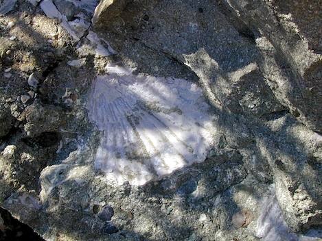
Forbush Flats is a delightful camp situated right in the middle of of the Santa Ynez Fault. Because of this, shell fossils are exposed in the rock in this area, making it a geologist’s paradise. You’ll find an apple orchard here, the only remnants of Fred Forbush’s pioneer homestead. Gidney Creek leads off to the left, which is interesting to explore. Or you can follow the main trail to the river.
DIRECTIONS
To reach Forbush Trail follow Gibraltar Road 6.5 miles to East Camino Cielo, then turn right and drive another 3.75 miles to the trailhead, which is opposite the end of Cold Springs Trail. These trails are at a saddle just after a downhill section of road. A trail sign on the left and a cement water tank on the right side of the road should make it easy to spot.
The Forbush Trail (actually, a continuation of the Cold Springs Trail) offers access to a number of parts of the upper Santa Ynez Valley and day loops, shuttle trips, or overnighters depending on the type of arrangements you make.
Originally the Cold Springs Trail was one of the main thoroughfares into the backcountry, leading from Montecito over the mountain crest, down past Forbush Flats, and through the upper part of the Santa Ynez drainage along Mono Creek. Eventually, the trail wound its way over a small gap in the San Rafael range known as the Puerto Suelo to Santa Barbara Canyon and the Cuyama Valley. When the Chumash revolted briefly in the 1820s, fleeing to the tule marshes in the lower San Joaquin Valley, this was the route taken by soldiers whose task was to round them up and bring them back.
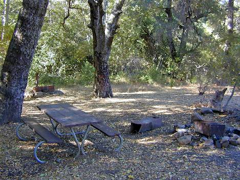
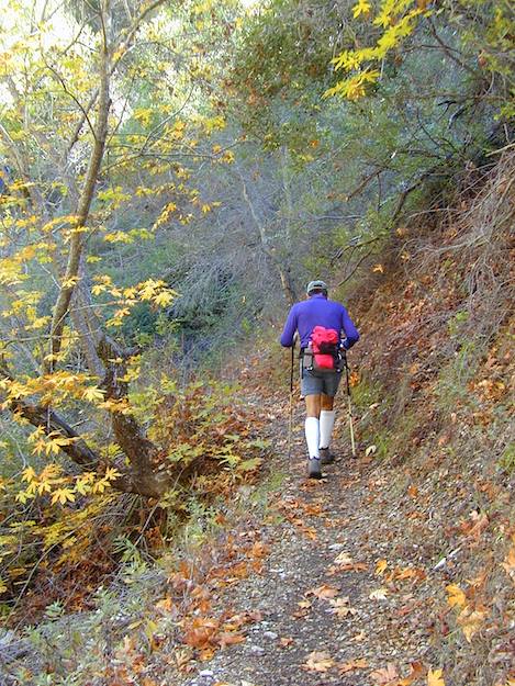
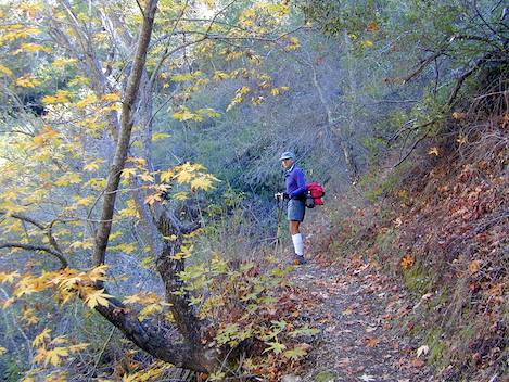
From the crest, the first 1.5 miles of the trail leads through chaparral down to Forbush Flats, dropping a thousand feet in elevation. The camp is pleasant, well shaded, and at the foot of Gidney Creek, which often flows year round though not always. Nearby is a small meadow, complete with an aging apple orchard, courtesy of Fred Forbush, who built a cabin there about 1910.
The camp is situated on top of the Santa Ynez Fault, which cuts directly through it, forming the crease along which Gidney Creek flows. Due to the uplifting that has occurred here, numerous layers of bedrock rich in fossil life are exposed here, making this an amateur geologist’s paradise. A wonderful afternoon can be spent here, either meandering down the creek checking out the exposed layers of bedrock or continuing down the trail toward the Santa Ynez River.
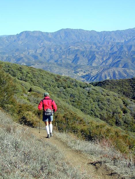
A trail intersection lies just north of the meadow. The main trail continues north, up over a 50-foot-high ridge and then down another 1,000 feet in elevation loss over 1.5 miles to the Santa Ynez River. Along the way are more fossils and a pool or two for refreshment. In late fall this is an absolutely spectacular hike with the maple trees filled with yellow leaves.
The right trail leads 2 miles east down through the Santa Ynez Fault and rugged chaparral to Cottam Camp which is located at the bottom end of Blue Canyon. The Santa Ynez River is just a half mile downstream from Cottam.
One of the best long day hikes can be made either by continuing down the Cold Springs Trail then following the river upstream to Blue Canyon and Cottam Camp, then back up to Forbush or in the other direction. My own preference is to head down to Cottam first then work my way down the river to Cold Springs Trail and head back up from there. One reason for this is the set of emerald-colored pools you’ll find not too far up from the river that provides a wonderful place to take a break.
CAR CAMPERS NOTE
One way to combine car camping and day hiking is to allow those who would like to hike to head down the Forbush Trail while the car campers continue on to the campsite. If your destination is Mono Debris Dam, the hikers can take the main trail down to the river. Just across it, Mono Trail follows the right side of the river for a half-mile then turns right and continues up Mono Creek for slightly more than a mile to the debris dam.
If you will be camping at P-Bar Flats or Mid-Santa Ynez Camp, have the hikers follow the trail to Forbush Flats then continue to the right to Cottam Camp and then down to the river. From there a dirt road wanders across the river to P-Bar Flats.


