
Upper Romero Trail Loop

TRAIL INFORMATION
Distance-5 miles
Elevation Gain-Elevation loss of 500′ and gain of 600′
Difficulty-Moderate
Topo-Carpinteria
View Photo Gallery
HIGHLIGHTS
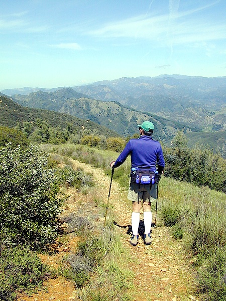
If you like great views, you’ll love this trail. The route follows Romero Road for 1.5 miles down towards until it intersects the Romero Trail, then follows this up to the top of the mountains. Though you will have a steep hike to the crest, once there you’ll feel like you are on top of the world.
DIRECTIONS
To reach the upper end of Romero Road follow Gibraltar Road 6.5 miles to East Camino Cielo, then turn right and drive another 6.5 miles to Romero Saddle where the road begins. The saddle is just after a downhill section and marks the end of the paved section of road and the beginning of Pendola Road which leads into the upper Santa Ynez Recreation Area. A cement water tank on the right side of the road marks the beginning of Romero Road and is easy to spot.
THE HIKE
From the saddle, follow Romero Road down toward the coast for 1.5 miles to its intersection with the Romero Trail. At this point turn left and take the upper section of the trail, which rises steeply through the chaparral for a mile to the mountaintop. At the crest are remnants of an old trail-the Island View Trail-which once yo-yo’ed across the eastern part of the crest towards Carpinteria. Some of it has been lost due to the construction of a fuelbreak along the top of the Santa Ynez Mountains and partly because of the encroachment of motorcycles.
Yet the view is still magnificent, the trail name still appropriate, and the feeling is one of almost being able to float over the land like a hang glider soaring on the currents.
From the crest you have several choices. The most direct is to head west following the ridgeline as it bobs up and down until you arrive back at Romero Saddle. A second choice is to continue north on Romero Trail, dropping down to Pendola Road. There you will turn left and follow it uphill for a half mile to the saddle. A third choice would be to head east on the old Island View Trail until you intersect the Divide Peak Jeepway. Turn left and walk down the jeepway to Pendola Road, then left again for 1.2 miles back up to the saddle.


