
Zaca Fire Update
Last Updated: August 9, 2007 7:00 pm

UPDATED: HMS 2007-08-09; Thermal MODIS: 2007-08-10 1000 (GMT); Fire Perimeters 2007-08-09; Sit Reports 2007-08-09
Last Updated: August 9, 2007 7:00 pm
Date/Time Started: July 4, 2007 10:53 am
Administrative Unit: Los Padres National Forest / Santa Barbara County Fire
County: Santa Barbara
Location: 15 miles NE of Buellton
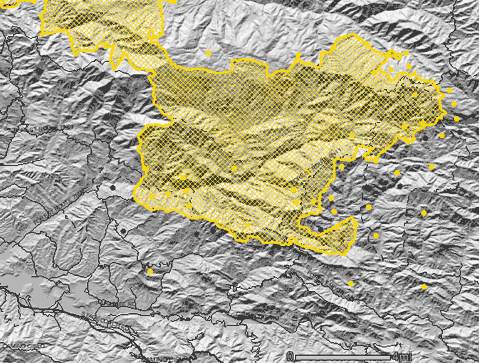
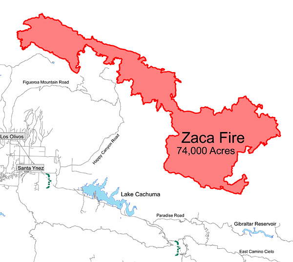
Acres Burned: 76,821 acres
Containment: 70% contained – 76,821 acres. Full containment expected on September 7, 2007.
Structures Destroyed: 1 outbuilding destroyed
Threatened: 483 homes and 112 outbuildings threatened
Evacuations: Please call 805-961-5770 for current information on evacuations.
Cause: Human
Cooperating Agencies: Santa Barbara County Fire, Los Angeles County Fire, Ventura County Fire, California Highway Patrol, American Red Cross
Total Fire Personnel: 2,482 (715 CAL FIRE)
Fire crews: 57 (16 CAL FIRE)
Engines: 133 (5 CAL FIRE)
Airtankers: 4
Helicopters: 21
Dozers: 27 (7 CAL FIRE)
Water tenders: 59
Costs to date: $56.9 million
Major Incident Command Team: Unified Command
Conditions: Fire remains in steep, rocky terrain with poor access, making direct fire attack very difficult. Lower relative humidity, much higher temperatures, and a decreasing marine layer is expected for the next three days. Strong down canyon winds are predicted in the evenings. Extreme fire behavior is expected north of Buckhorn Creek and in the Indian Creek drainage of the Dick Smith Wilderness. The fire continues to push north with extreme fire behavior.
An evacuation order remains in effect for Peachtree, Paradise Road and the Lower Santa Ynez River Road to Gibraltar Dam. Highway 154 is expected to re-open on August 9 at 8 p.m.
PLEASE CALL 805-961-5770 FOR THE MOST CURRENT EVACUATION AND FIRE INFORMATION.
Phone Numbers (805) 961-5770 (Zaca Fire Information)


